Meteor over Midtjylland 2017-01-03 20:17:00 UTC
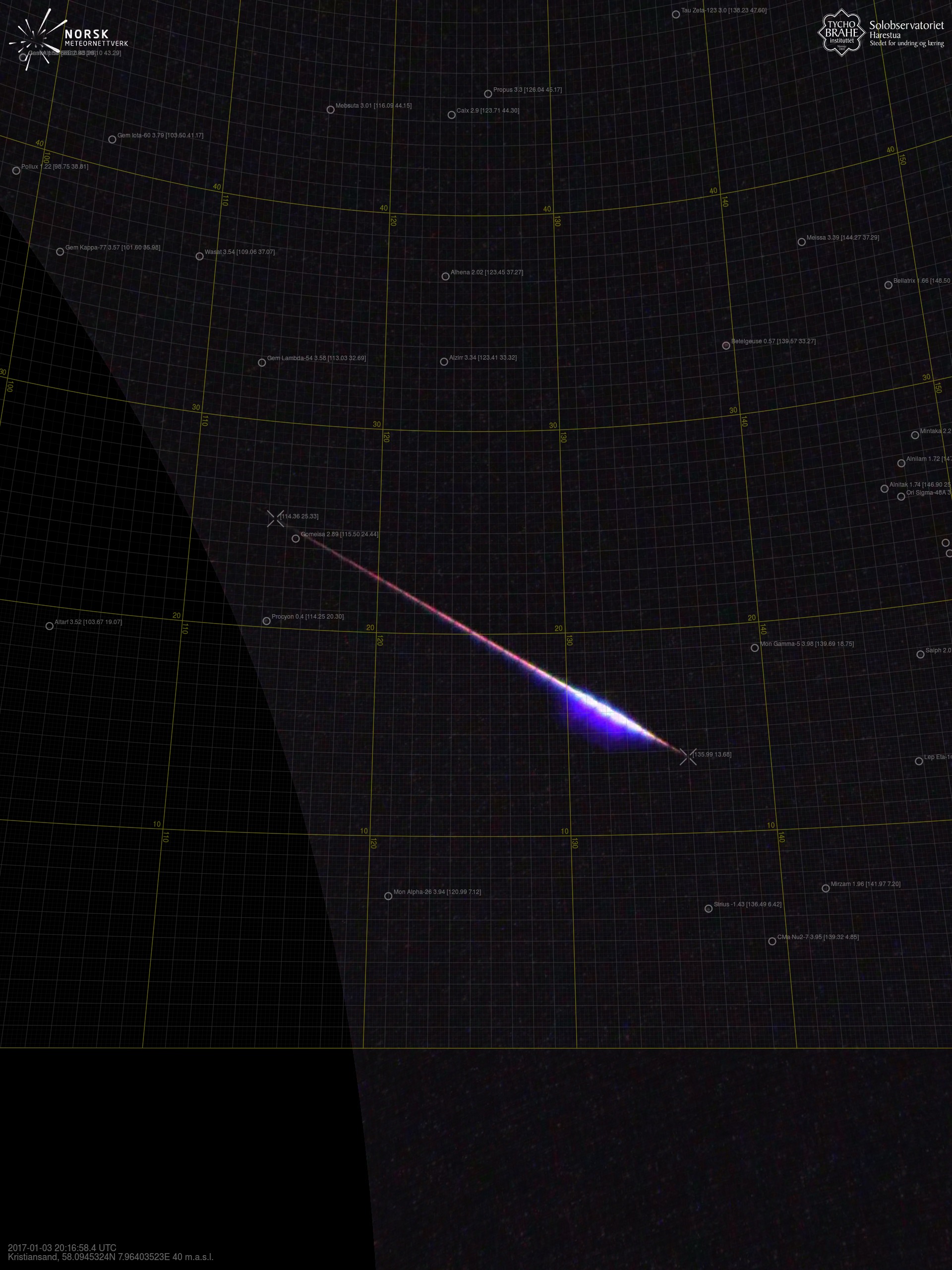
Kristiansand – 2
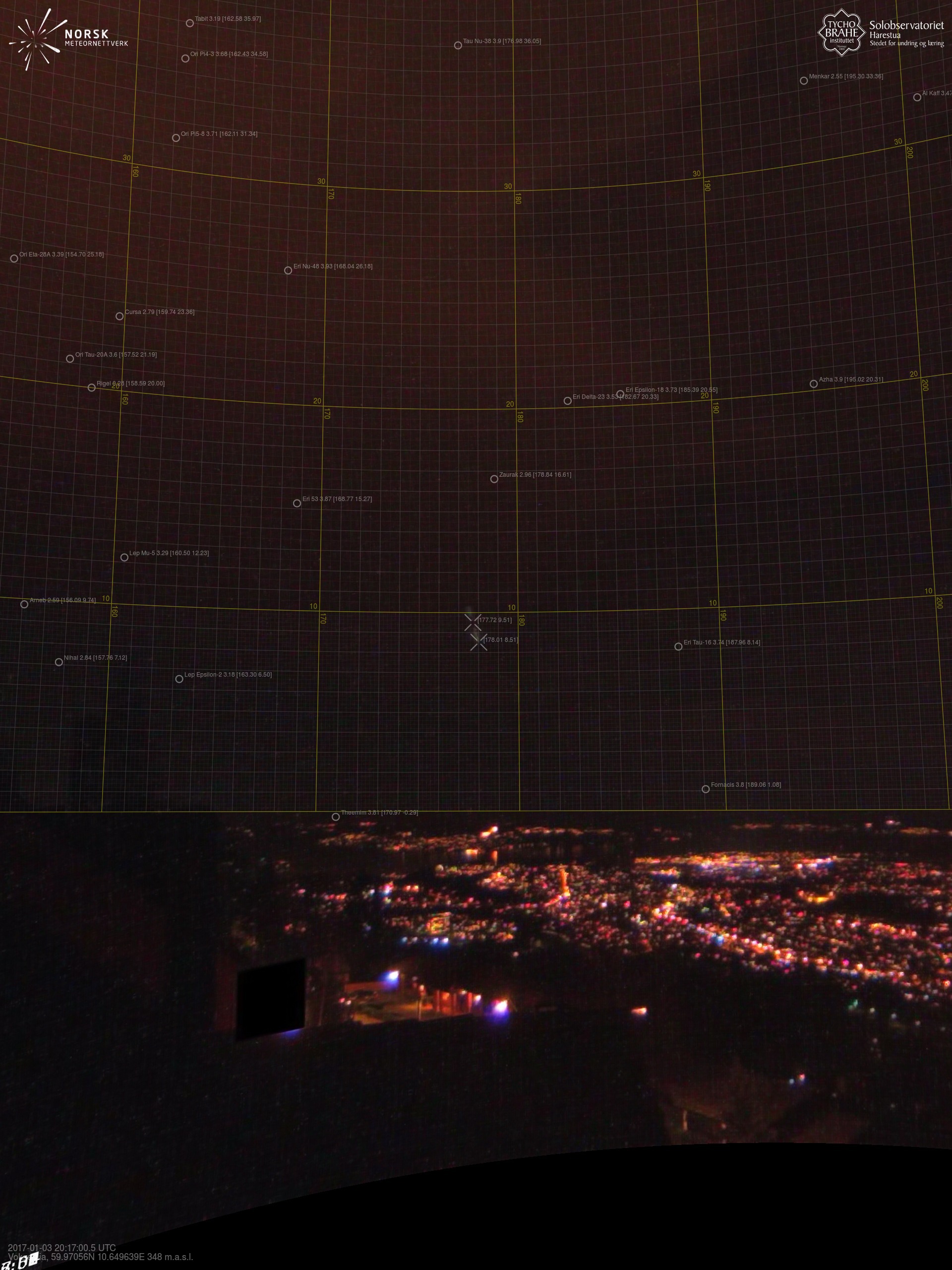
Voksenlia – 1
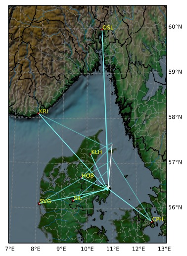
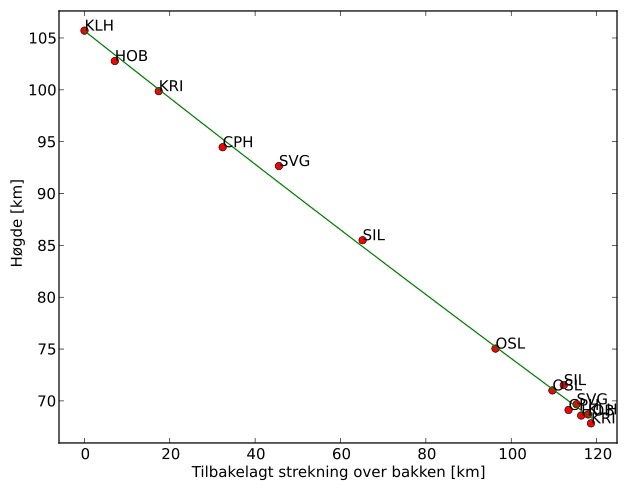
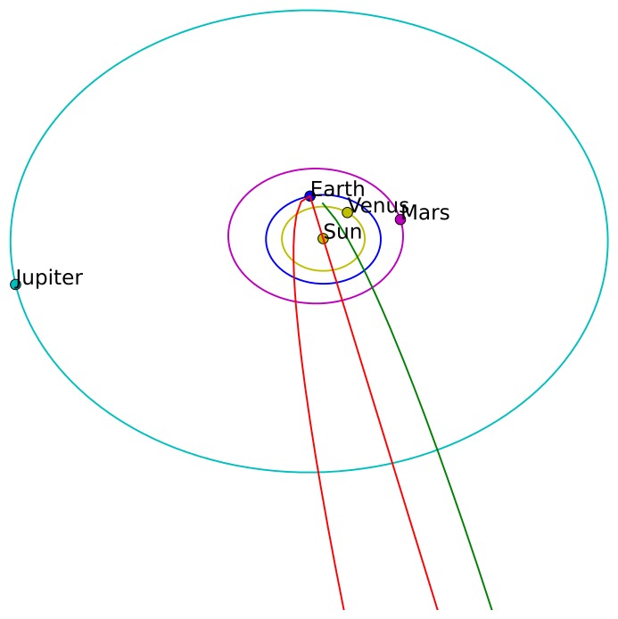
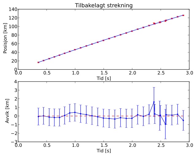
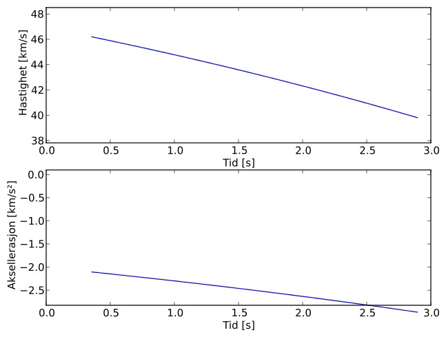
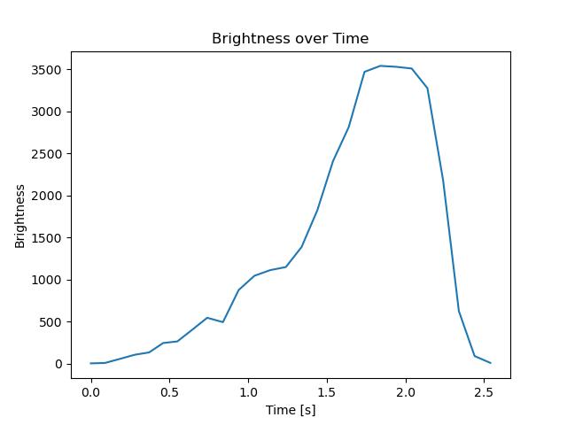
Meteorens atmosfæriske bane:
| Meteoroidens baneelement:
|
Images
Text Files
Meteorens atmosfæriske bane:
| Meteoroidens baneelement:
|