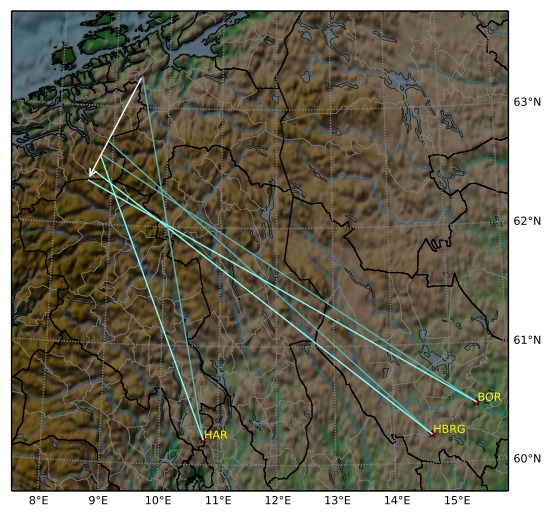
Meteorens atmosfæriske bane:
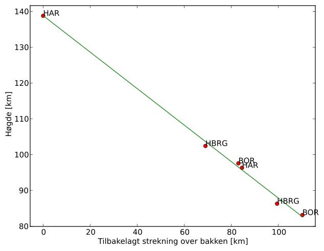
| Starthøgde: | 138,8 km |
| Slutthøgde: | 82,7 km |
| Startposisjon: | 63,266N 9,488E |
| Sluttposisjon: | 62,370N 8,569E |
| Retning: | 205,5° |
| Fallvinkel: | 27,0° |
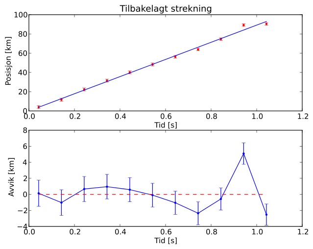
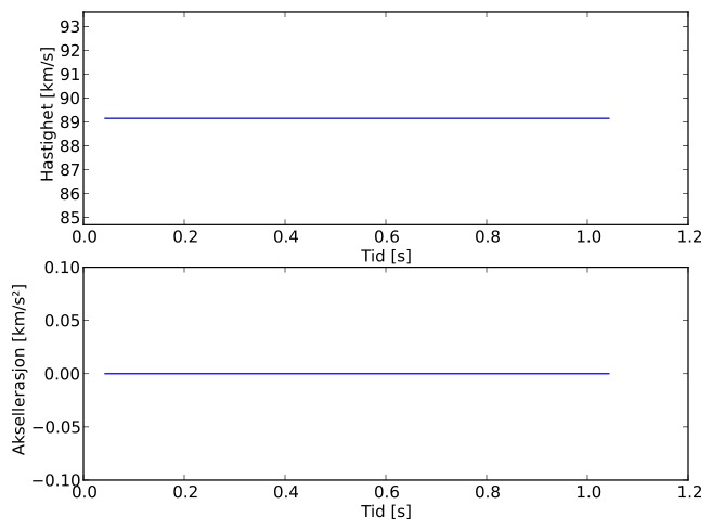
| Inngangshastighet: | 89,2 km/s |
| Radiantens rektascensjon: | 08:57 (134,3°) |
| Radiantens deklinasjon: | 50,0° |
| Meteorsverm: | sporadisk |
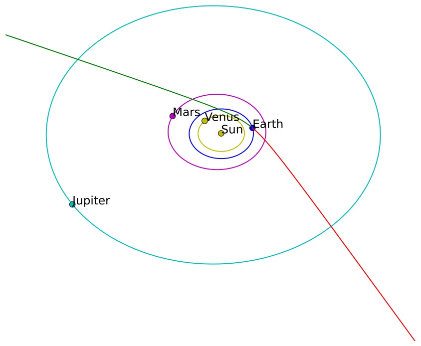
| Meteoroidens baneelement:
| Perihelavstand: | 0,914 AU |
| Eksentrisitet: | 3,731 |
| Inklinasjon: | 132,1° |
| Knutelengde: | 192,6° |
| Perihelargument: | 153,0° |
| Midlere anomali: | 59,5° |
| Epoke: | 2017 OCT 05 |
|