Meteorens atmosfæriske bane:
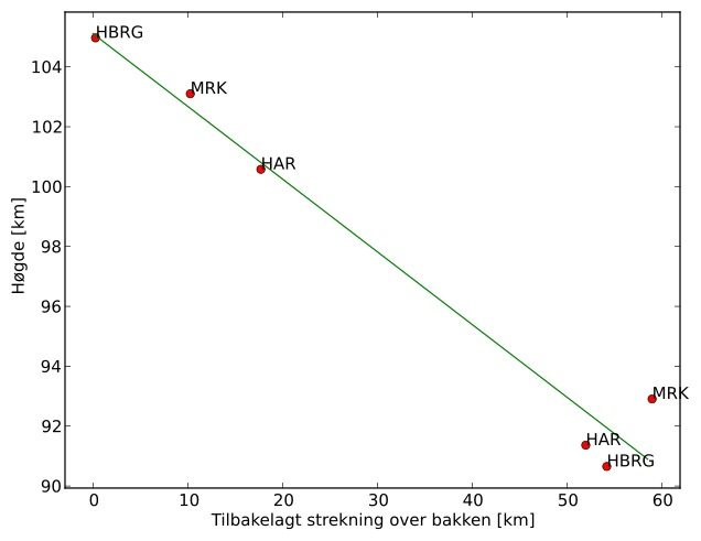
| Starthøgde: | 105,1 km |
| Slutthøgde: | 90,9 km |
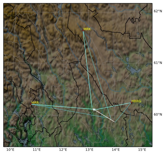
| Startposisjon: | 59,870N 14,012E |
| Sluttposisjon: | 60,148N 13,119E |
| Retning: | 302,4° |
| Fallvinkel: | 13,6° |
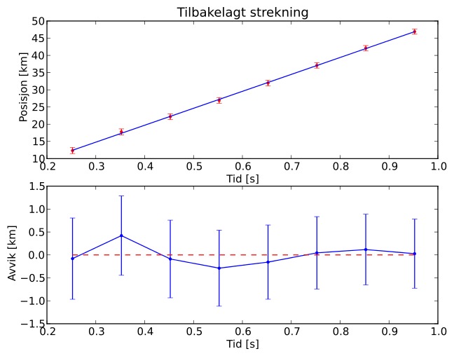
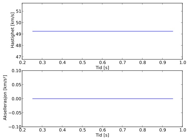
| Inngangshastighet: | 49,2 km/s |
| Radiantens rektascensjon: | 08:35 (128,9°) |
| Radiantens deklinasjon: | -4,3° |
| Meteorsverm: | sigma-hydridene |
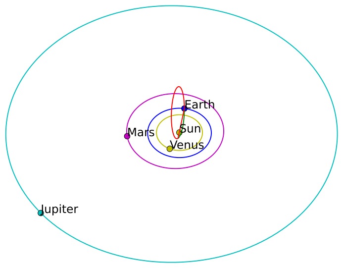
| Meteoroidens baneelement:
| Perihelavstand: | 0,205 AU |
| Eksentrisitet: | 0,839 |
| Inklinasjon: | 104,0° |
| Knutelengde: | 80,8° |
| Perihelargument: | 137,3° |
| Midlere anomali: | 331,9° |
| Epoke: | 2017 DEC 12 |
|