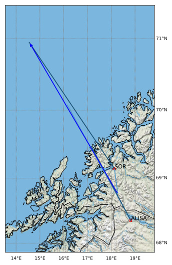
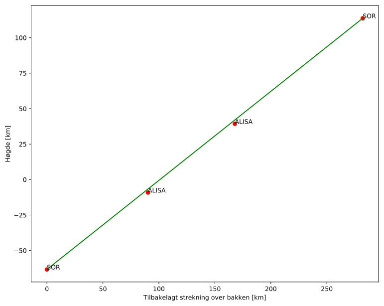
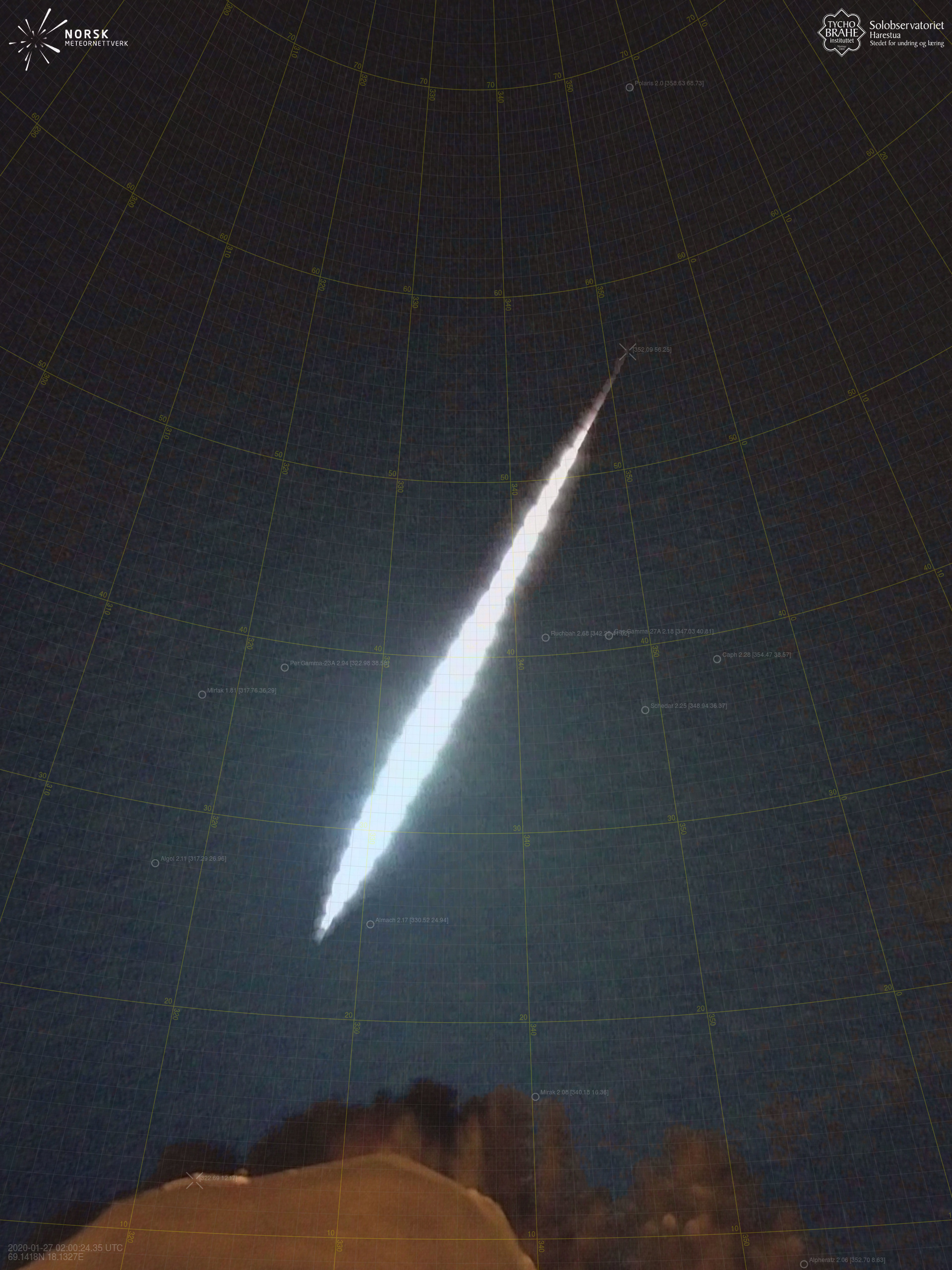
Meteorens atmosfæriske bane:
| Starthøgde: | -63,3 km |
| Slutthøgde: | 113,7 km |
| Startposisjon: | 68,761N 18,279E |
| Sluttposisjon: | 70,950N 14,554E |
| Retning: | 331,4° |
| Fallvinkel: | -32,1° |
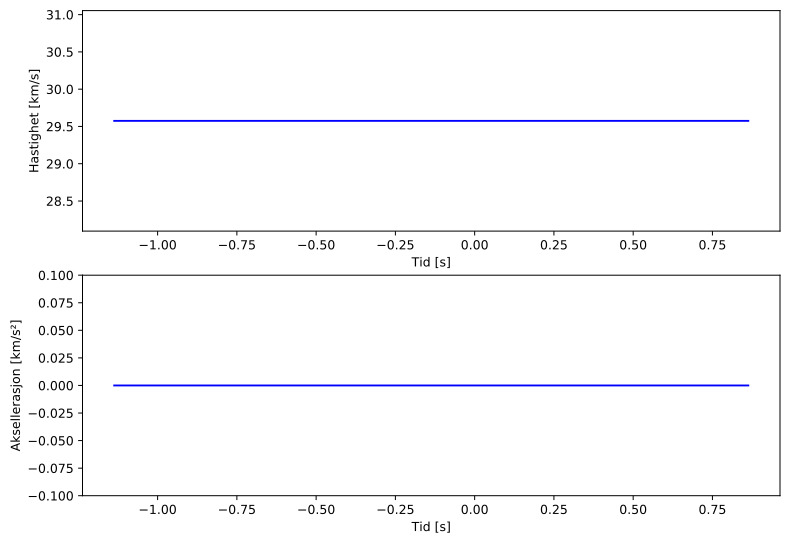
| Inngangshastighet: | 29,6 km/s |
| Radiantens rektascensjon: | 02:06 (31,5°) |
| Radiantens deklinasjon: | 47,6° |
| Meteorsverm: | sporadisk |
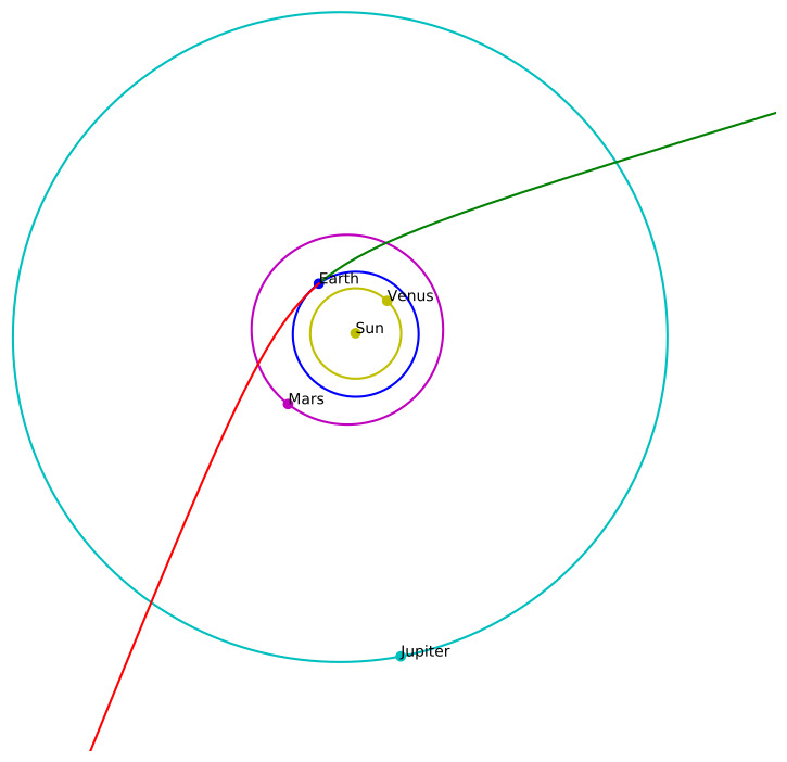
| Meteoroidens baneelement:
| Perihelavstand: | 0,981 AU |
| Eksentrisitet: | 2,355 |
| Inklinasjon: | 15,5° |
| Knutelengde: | 306,3° |
| Perihelargument: | 186,1° |
| Midlere anomali: | -5,2° |
| Epoke: | 2020 JAN 27 |
|