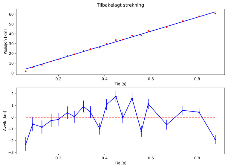
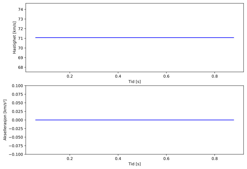
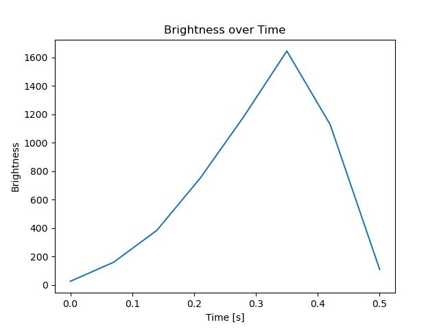
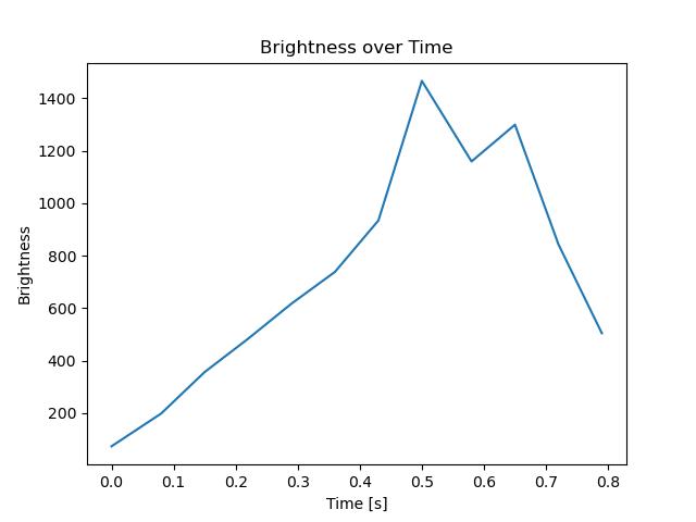
Meteor over Salangen 2020-02-22 22:56:25 UTC
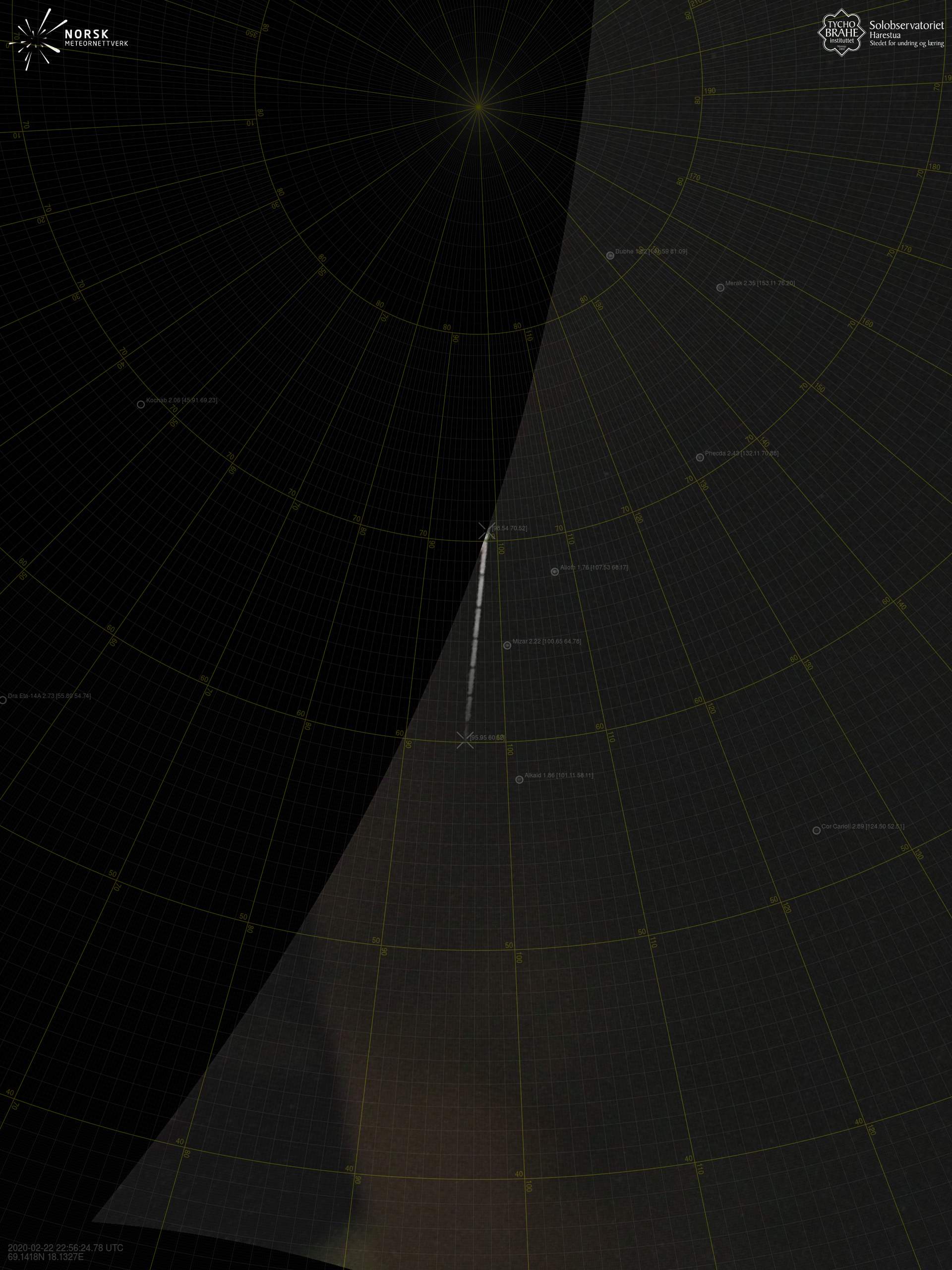
Sørreisa – 1
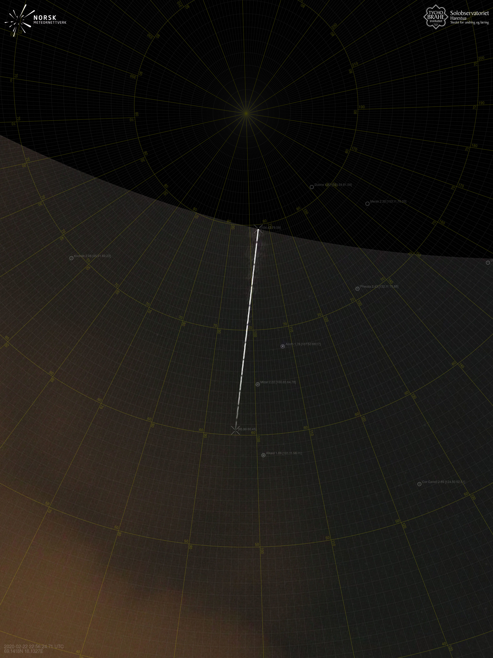
Sørreisa – 2
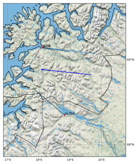
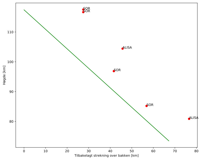
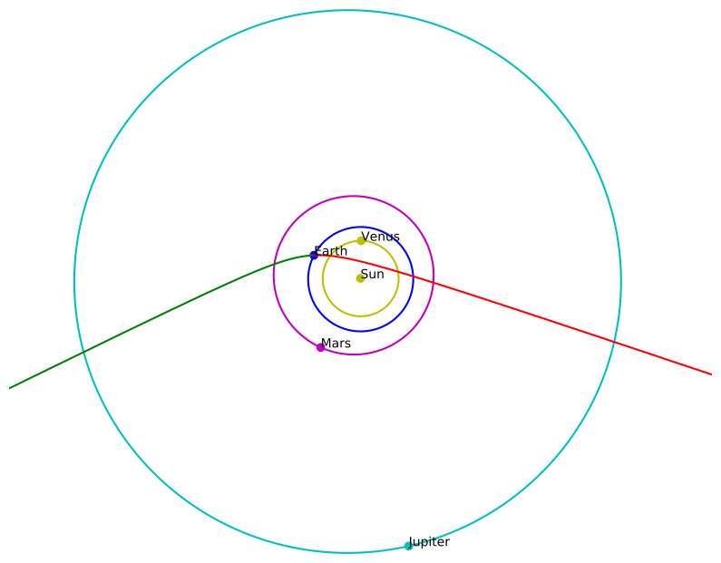
Meteorens atmosfæriske bane:
| Meteoroidens baneelement:
|
Images
Text Files
Images
Text Files
Meteorens atmosfæriske bane:
| Meteoroidens baneelement:
|