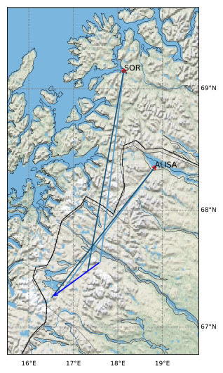
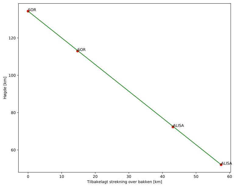
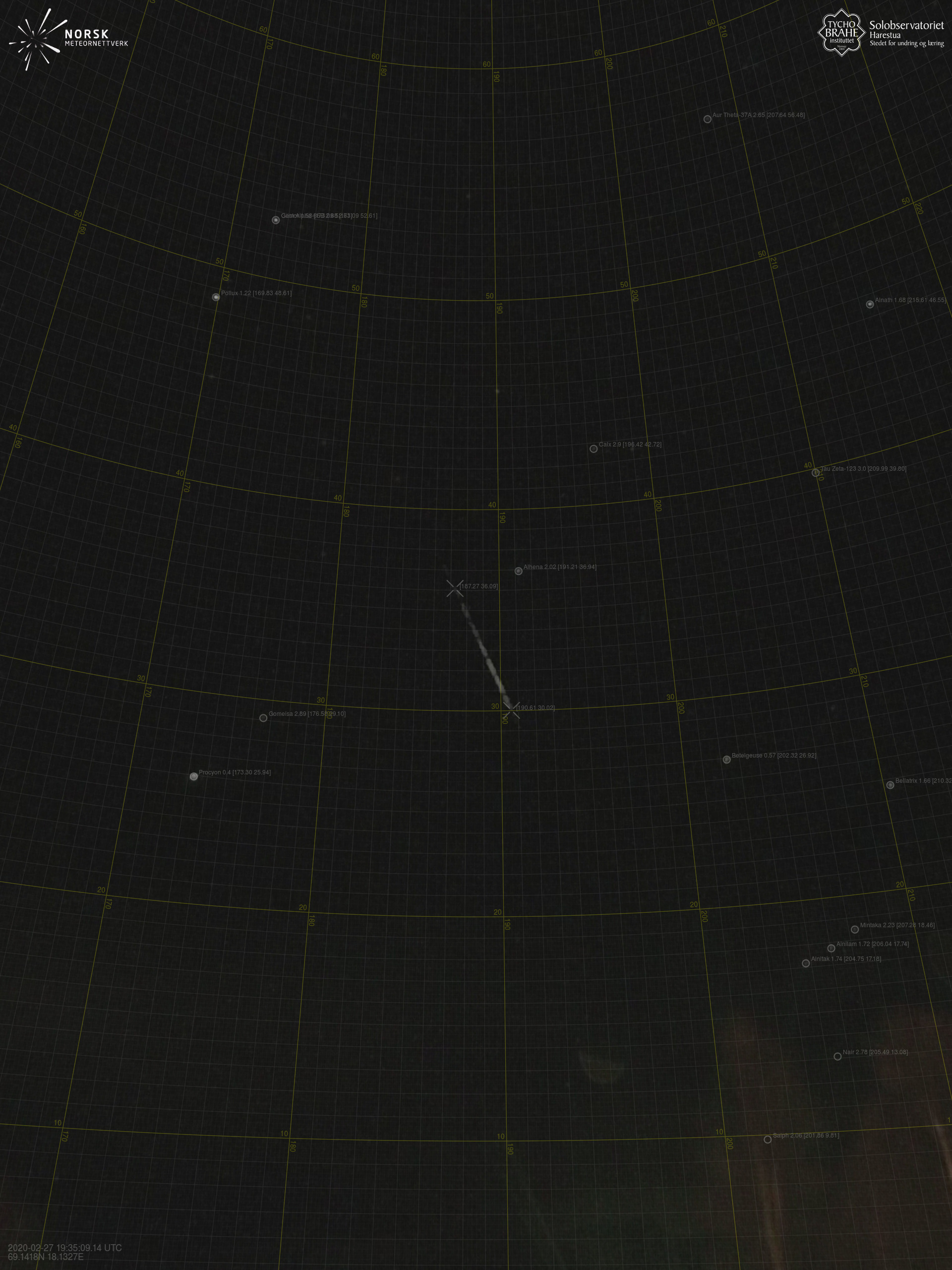
Meteorens atmosfæriske bane:
| Starthøgde: | 134,4 km |
| Slutthøgde: | 52,1 km |
| Startposisjon: | 67,564N 17,606E |
| Sluttposisjon: | 67,260N 16,519E |
| Retning: | 234,4° |
| Fallvinkel: | 55,1° |
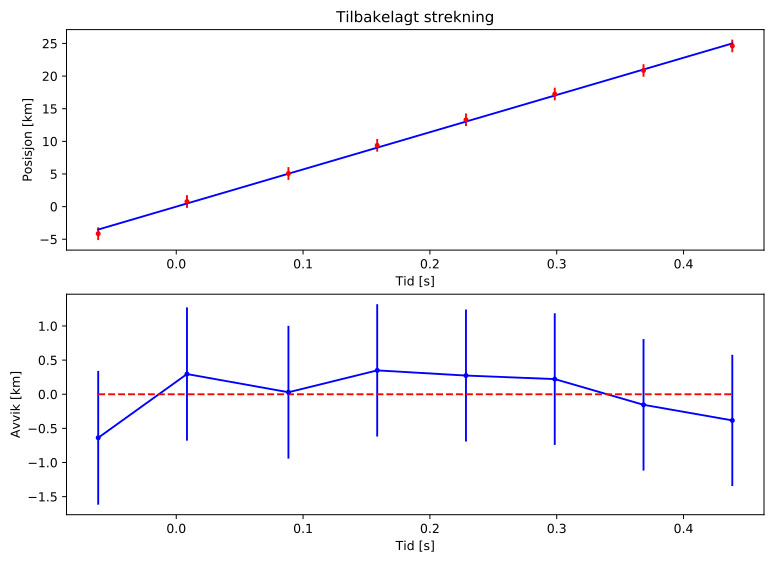
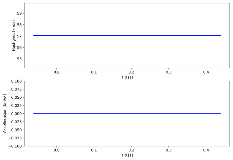
| Inngangshastighet: | 57,0 km/s |
| Radiantens rektascensjon: | 13:11 (197,9°) |
| Radiantens deklinasjon: | 62,3° |
| Meteorsverm: | sporadisk |
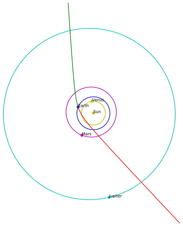
| Meteoroidens baneelement:
| Perihelavstand: | 0,873 AU |
| Eksentrisitet: | 3,316 |
| Inklinasjon: | 56,3° |
| Knutelengde: | 338,4° |
| Perihelargument: | 212,2° |
| Midlere anomali: | -59,6° |
| Epoke: | 2020 FEB 27 |
|