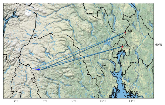
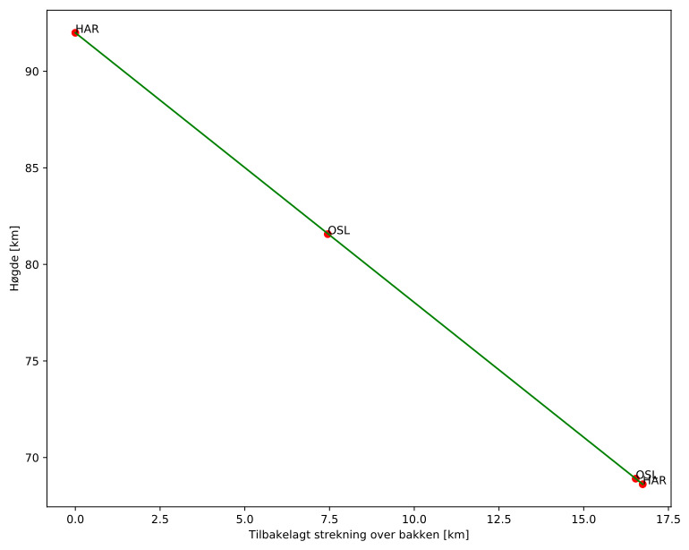
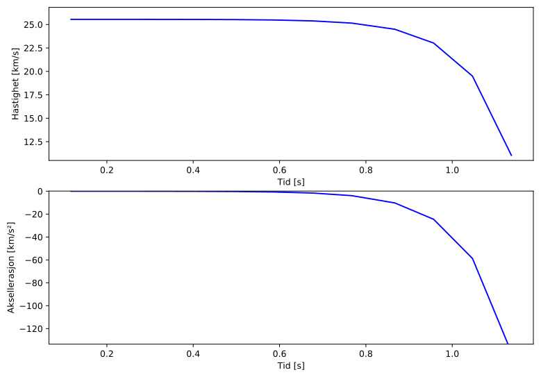
Meteorens atmosfæriske bane:
| Starthøgde: | 92,0 km |
| Slutthøgde: | 68,6 km |
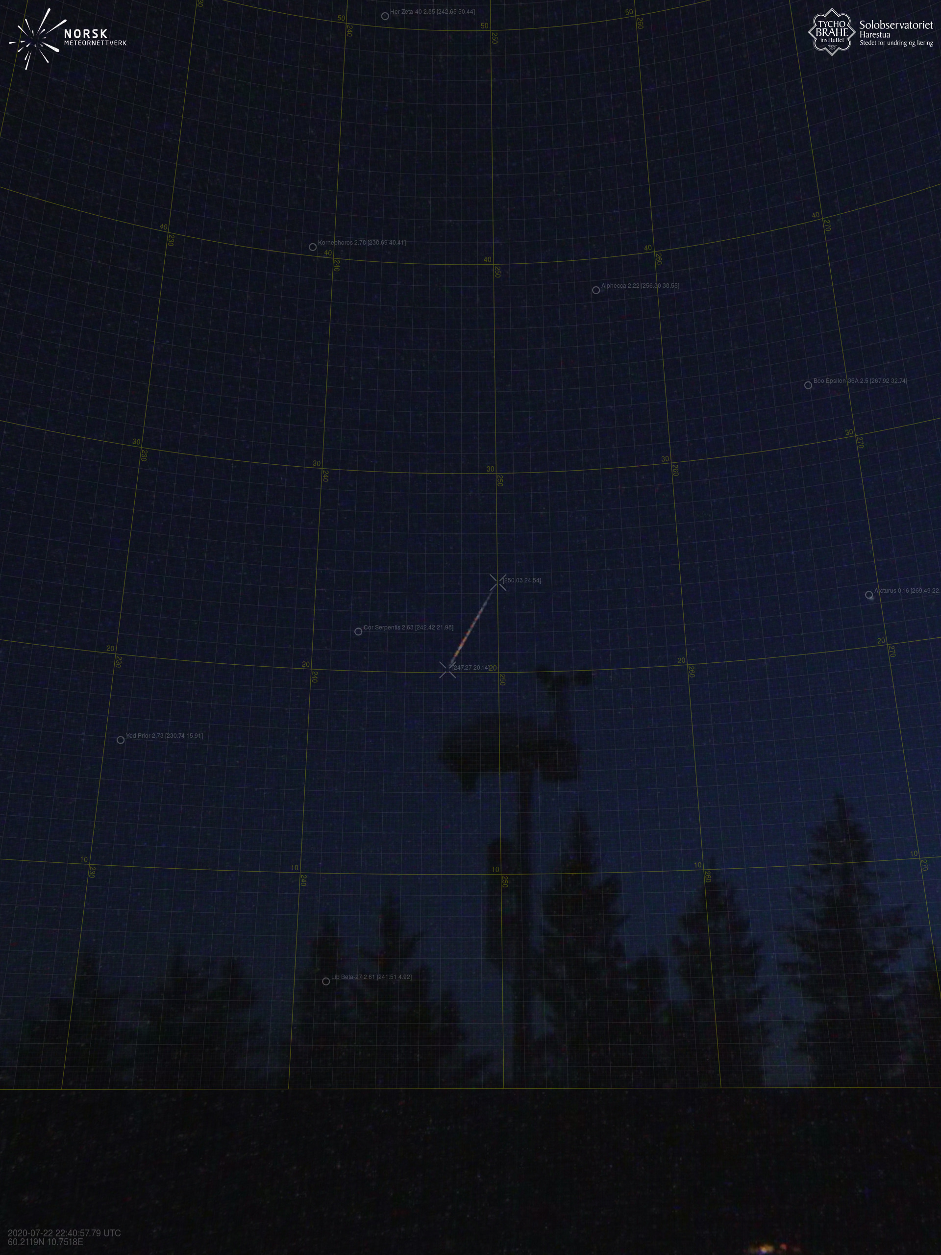
| Startposisjon: | 59,587N 7,567E |
| Sluttposisjon: | 59,566N 7,862E |
| Retning: | 97,8° |
| Fallvinkel: | 54,4° |
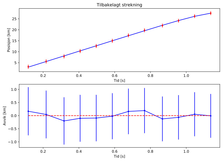
| Inngangshastighet: | 24,6 km/s |
| Radiantens rektascensjon: | 15:07 (227,0°) |
| Radiantens deklinasjon: | 46,0° |
| Meteorsverm: | sporadisk |
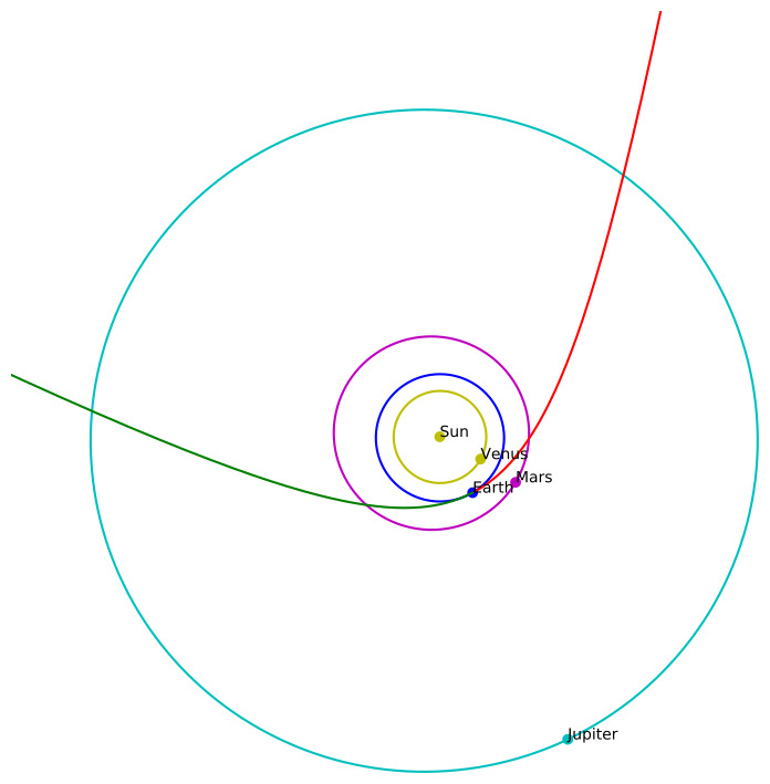
| Meteoroidens baneelement:
| Perihelavstand: | 1,015 AU |
| Eksentrisitet: | 1,284 |
| Inklinasjon: | 25,3° |
| Knutelengde: | 120,3° |
| Perihelargument: | 176,1° |
| Midlere anomali: | 0,4° |
| Epoke: | 2020 JUL 22 |
|