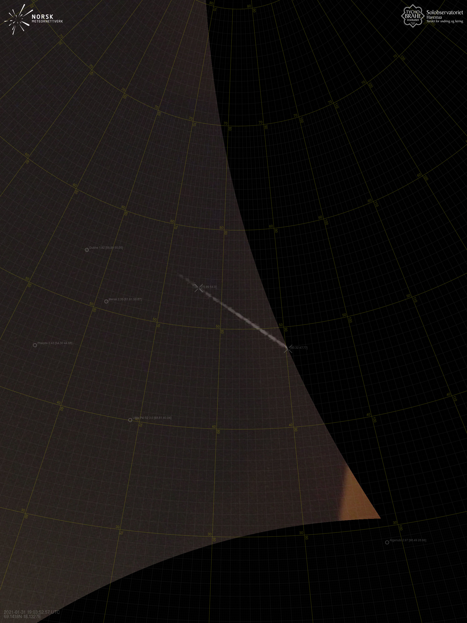
Meteor over Målselv 2021-01-31 19:03:51 UTC

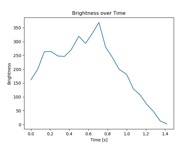
Sørreisa – 1

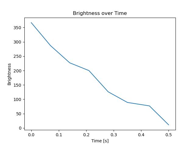
Sørreisa – 2
Sørreisa – 4
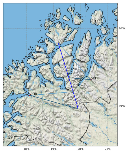
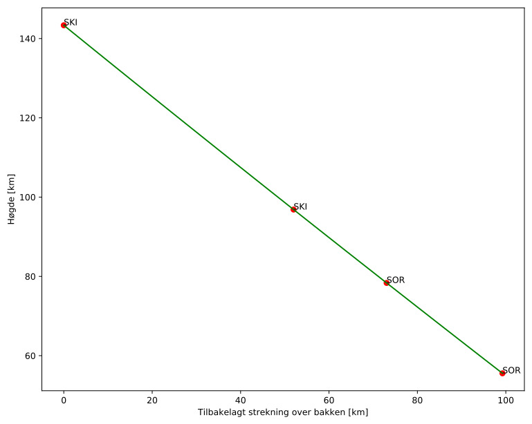
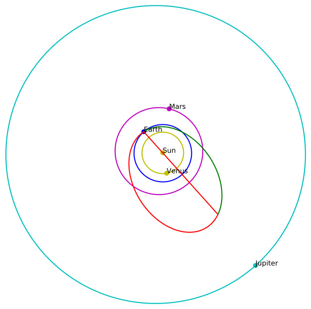
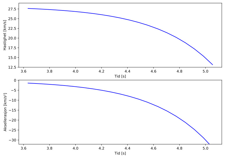
Meteorens atmosfæriske bane:
| Meteoroidens baneelement:
|

Images
Text Files
Images
Text Files
Images
Text Files