Meteor over Nord-Odal 2021-03-05 04:03:15 UTC
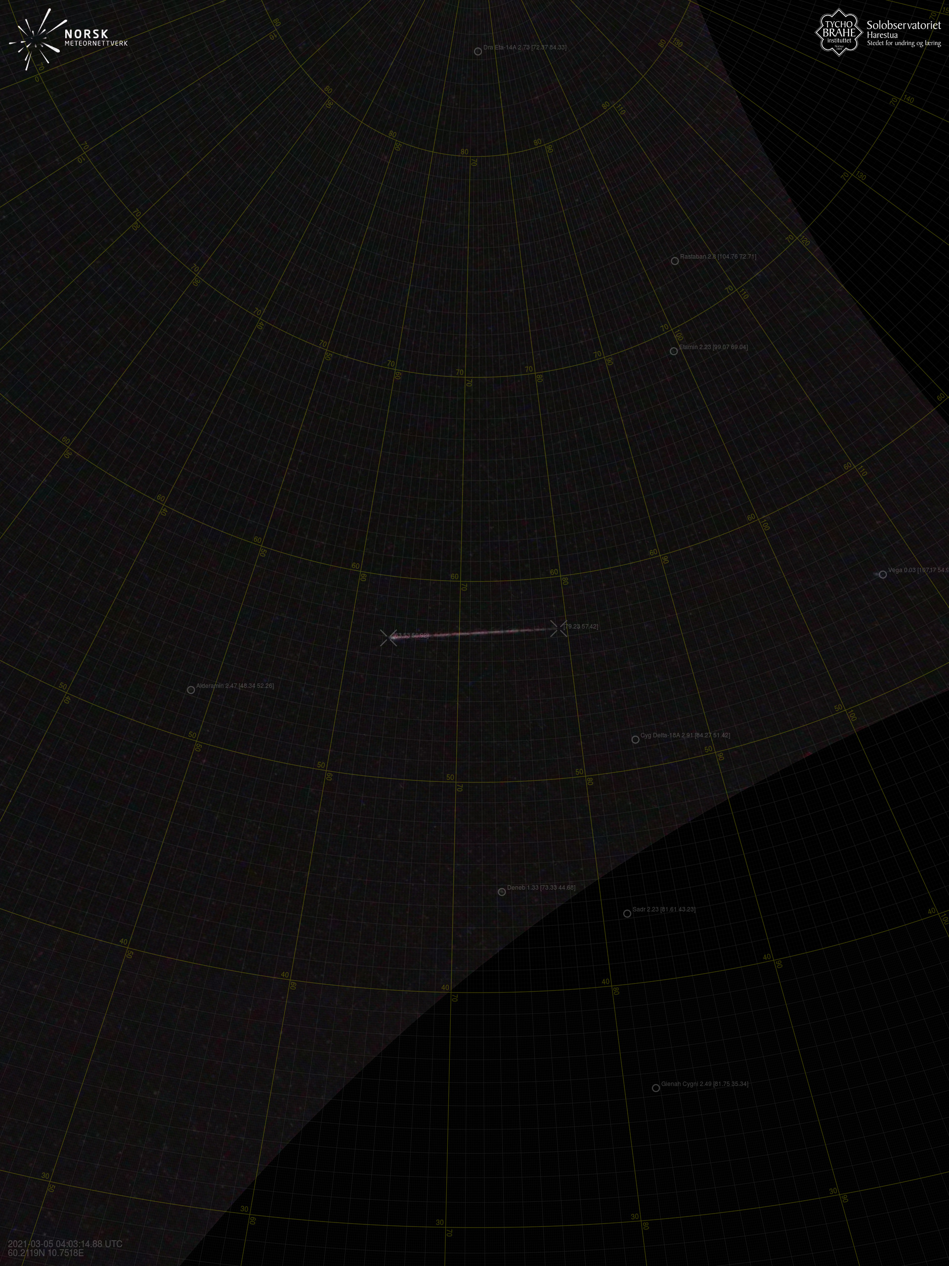
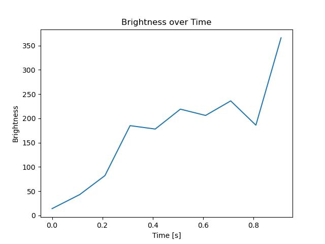
Harestua – 2

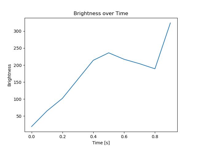
Harestua – 3
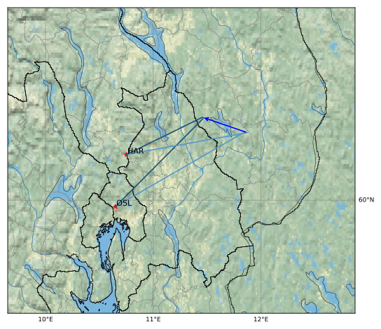
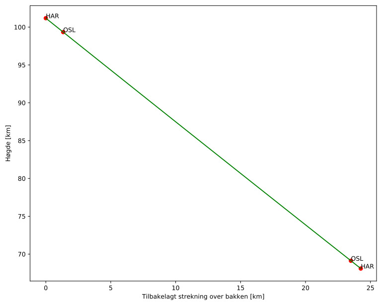
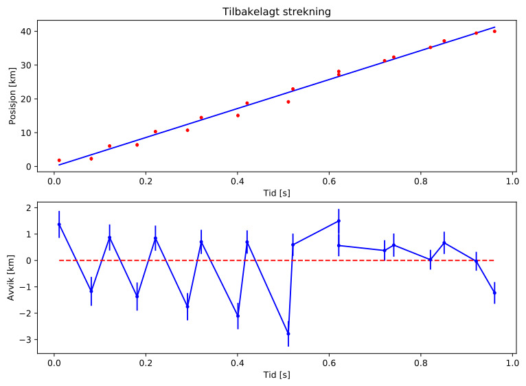
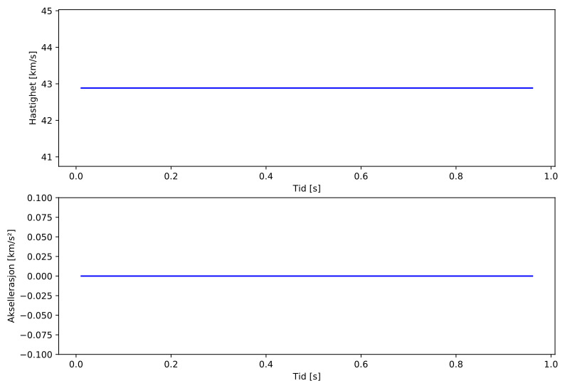
Meteorens atmosfæriske bane:
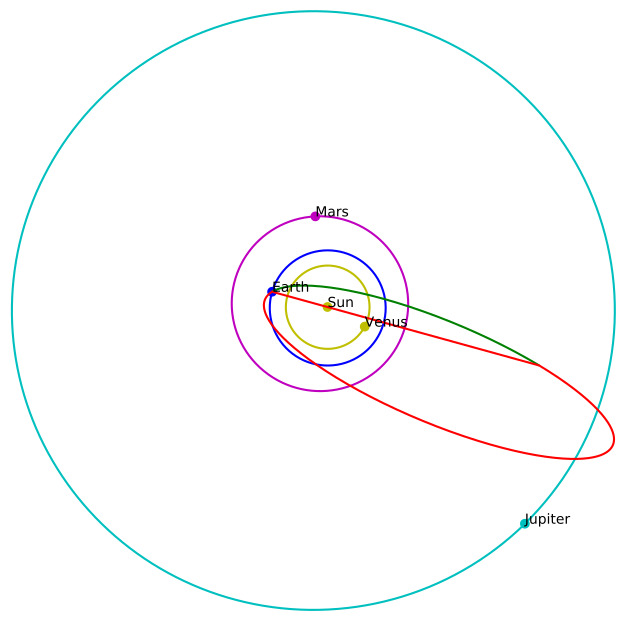
| Meteoroidens baneelement:
|
Images
Text Files
Images
Text Files
Meteorens atmosfæriske bane:
| Meteoroidens baneelement:
|