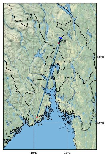
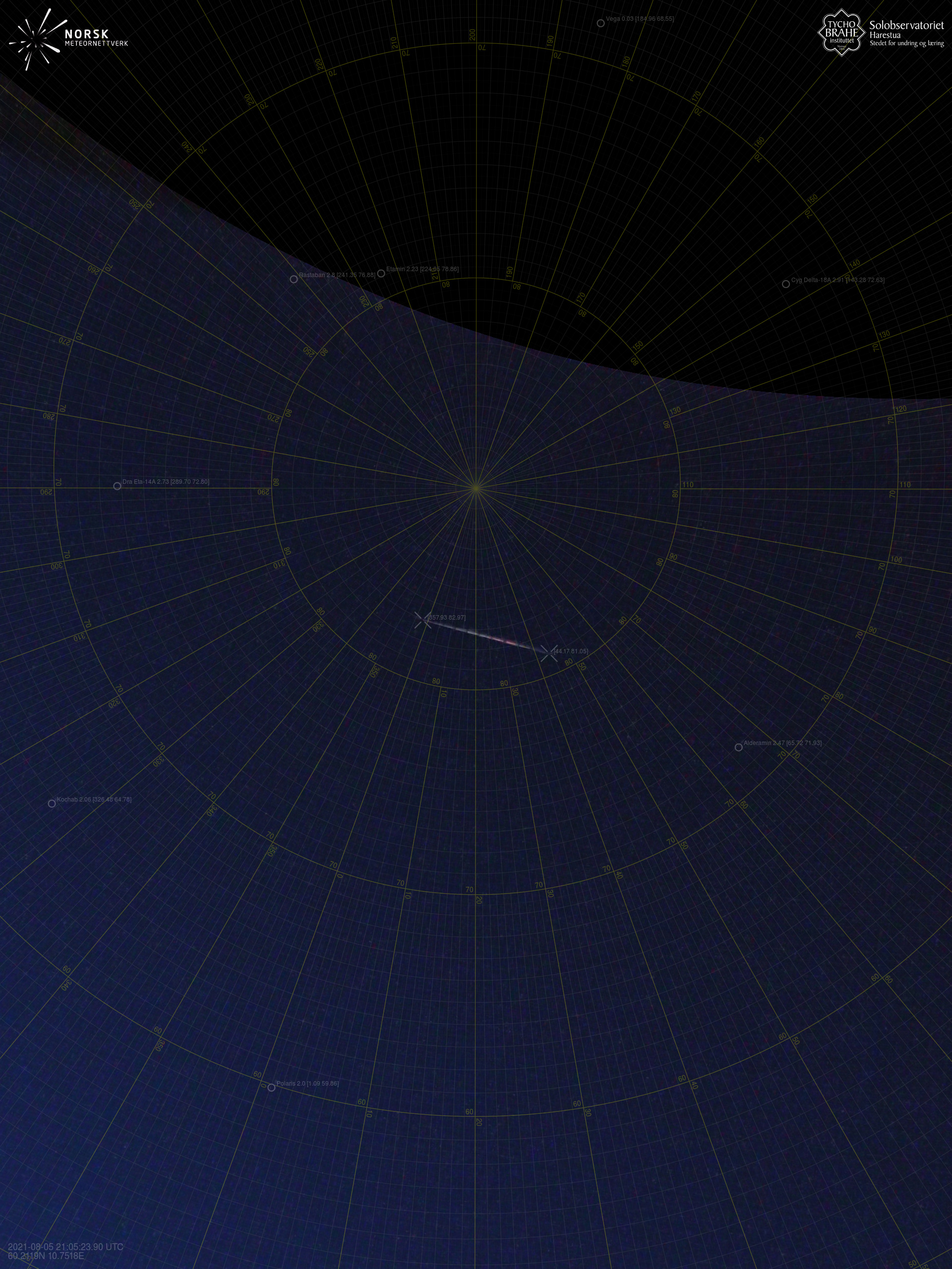
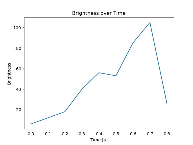
Meteorens atmosfæriske bane:
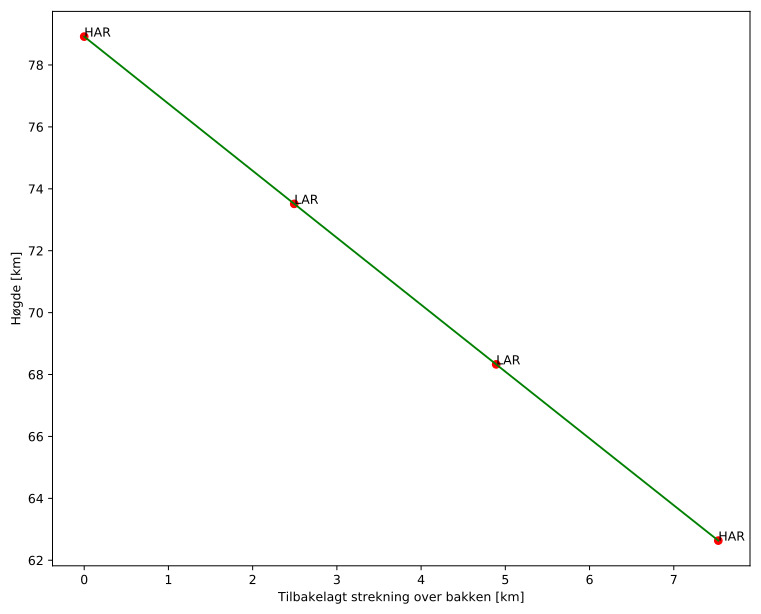
| Starthøgde: | 78,9 km |
| Slutthøgde: | 62,6 km |
| Startposisjon: | 60,298N 10,746E |
| Sluttposisjon: | 60,274N 10,874E |
| Retning: | 110,1° |
| Fallvinkel: | 65,2° |
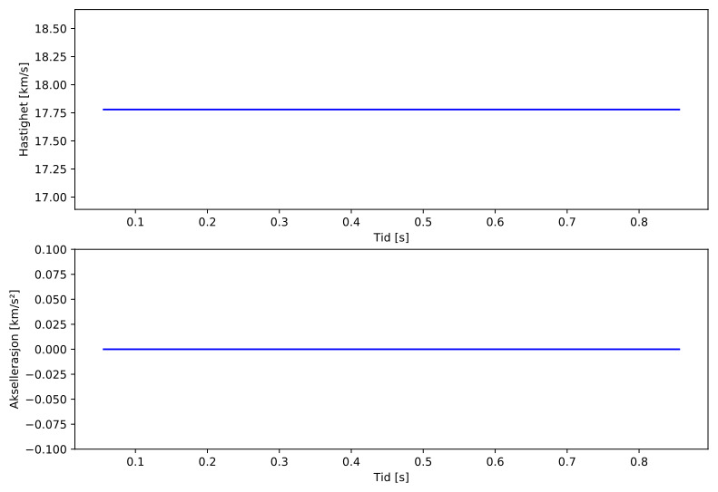
| Inngangshastighet: | 17,8 km/s |
| Radiantens rektascensjon: | 15:00 (225,0°) |
| Radiantens deklinasjon: | 57,3° |
| Meteorsverm: | sporadisk |
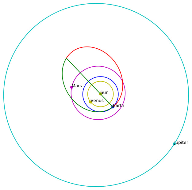
| Meteoroidens baneelement:
| Perihelavstand: | 1,002 AU |
| Eksentrisitet: | 0,486 |
| Inklinasjon: | 21,2° |
| Knutelengde: | 133,4° |
| Perihelargument: | 164,0° |
| Midlere anomali: | 4,9° |
| Epoke: | 2021 AUG 05 |
|