🇳🇴
🇬🇧
🇩🇪
🇨🇿
🇫🇮
Meteor over
2021-09-11
22:16:12 UTC
KML file
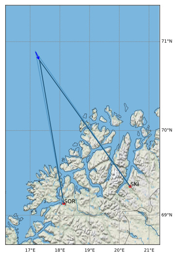
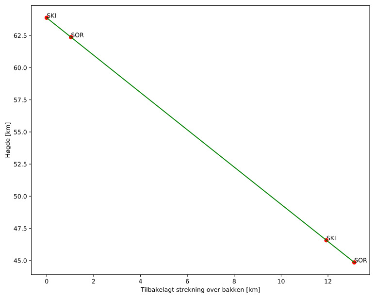
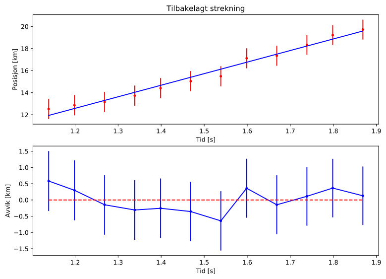
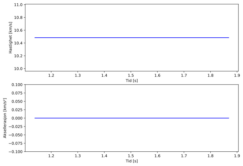
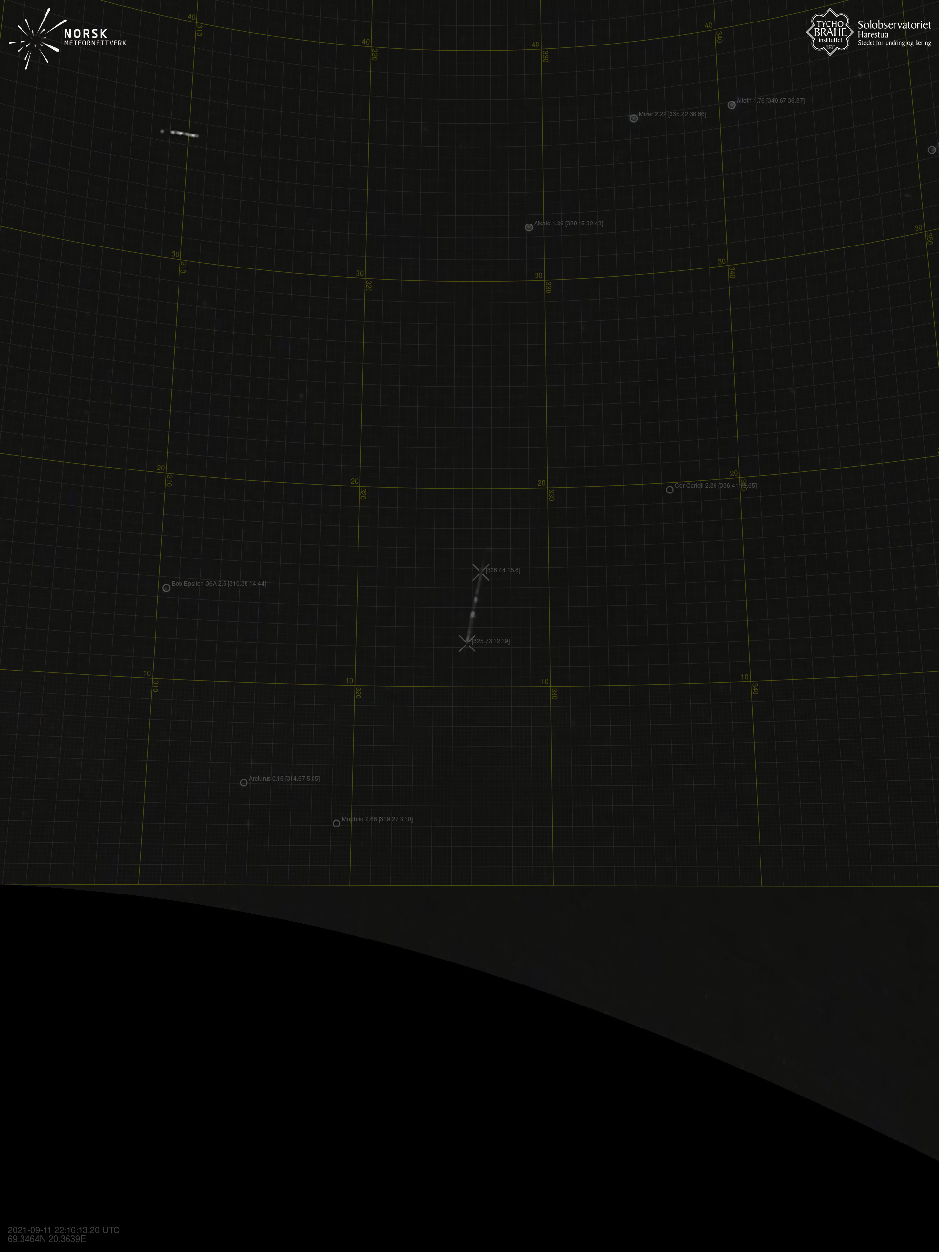
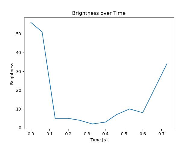
Meteorens atmosfæriske bane
:
Starthøgde:
63,9 km
Slutthøgde:
44,9 km
Startposisjon:
70,895N 17,170E
Sluttposisjon:
70,788N 17,320E
Retning:
155,3°
Fallvinkel:
55,4°
Inngangshastighet:
10,5 km/s
Skibotn – 4
Videos
Gnomonic
Gnomonic with coordinates
Original
Original with coordinates
Images
Gnomonic
Gnomonic with coordinates
Uncorrected gnomonic with coordinates
Gnomonic with labels
Uncorrected gnomonic with labels
Original
Original with coordinates
Original with mask
Text Files
Detection
Observation
Coordinates
Error Messages
Log