🇳🇴
🇬🇧
🇩🇪
🇨🇿
🇫🇮
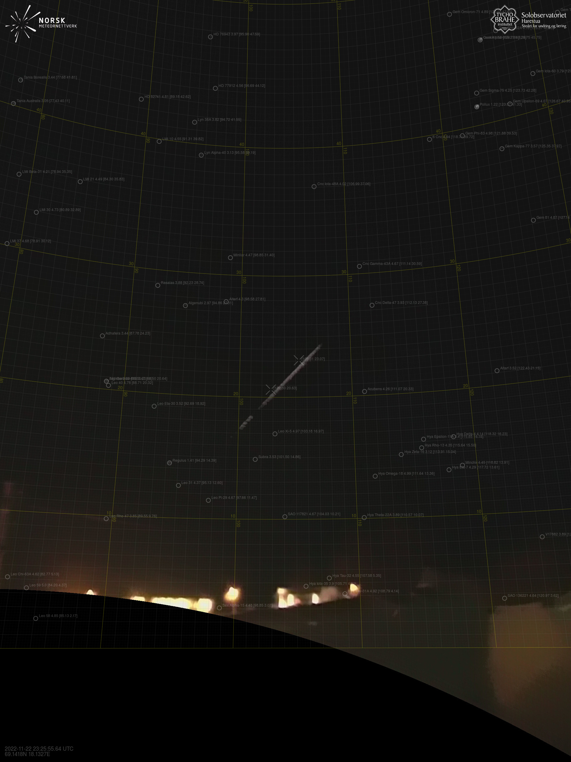
Meteor over Kautokeino
2022-11-22
23:25:54 UTC
KML file
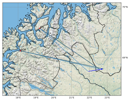
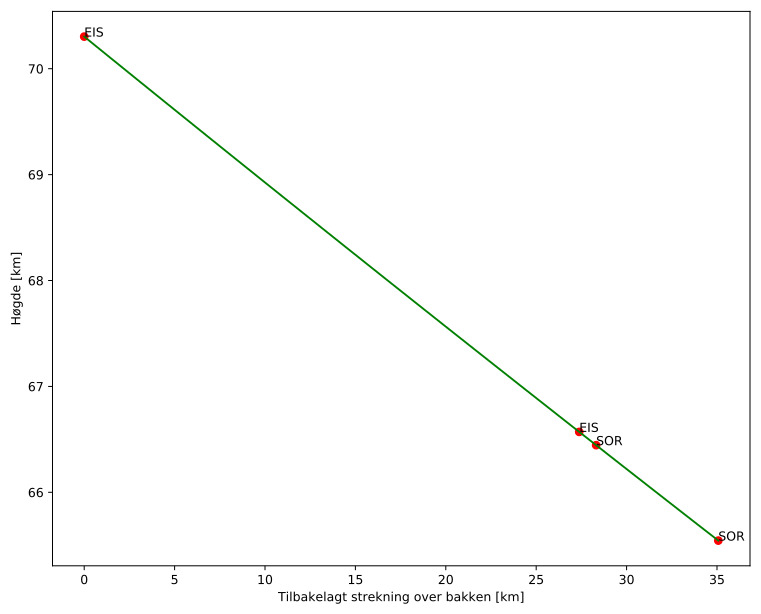
Meteorens atmosfæriske bane
:
Starthøgde:
70,3 km
Slutthøgde:
65,5 km
Startposisjon:
68,724N 21,928E
Sluttposisjon:
68,776N 22,787E
Retning:
80,2°
Fallvinkel:
7,8°
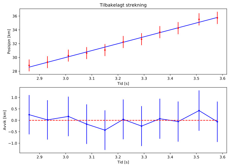
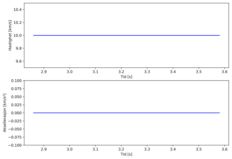
Inngangshastighet:
10,0 km/s
Sørreisa – 2
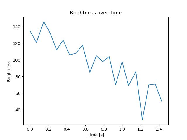
Videos
Gnomonic
Gnomonic with coordinates
Original
Original with coordinates
Images
Gnomonic
Gnomonic with coordinates
Uncorrected gnomonic with coordinates
Gnomonic with labels
Uncorrected gnomonic with labels
Original
Original with coordinates
Original with mask
Text Files
Detection
Observation
Coordinates
Error Messages
Log