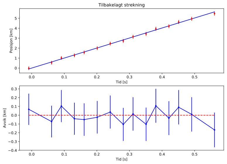
Meteor over Kåfjord 2022-12-12 23:59:42 UTC
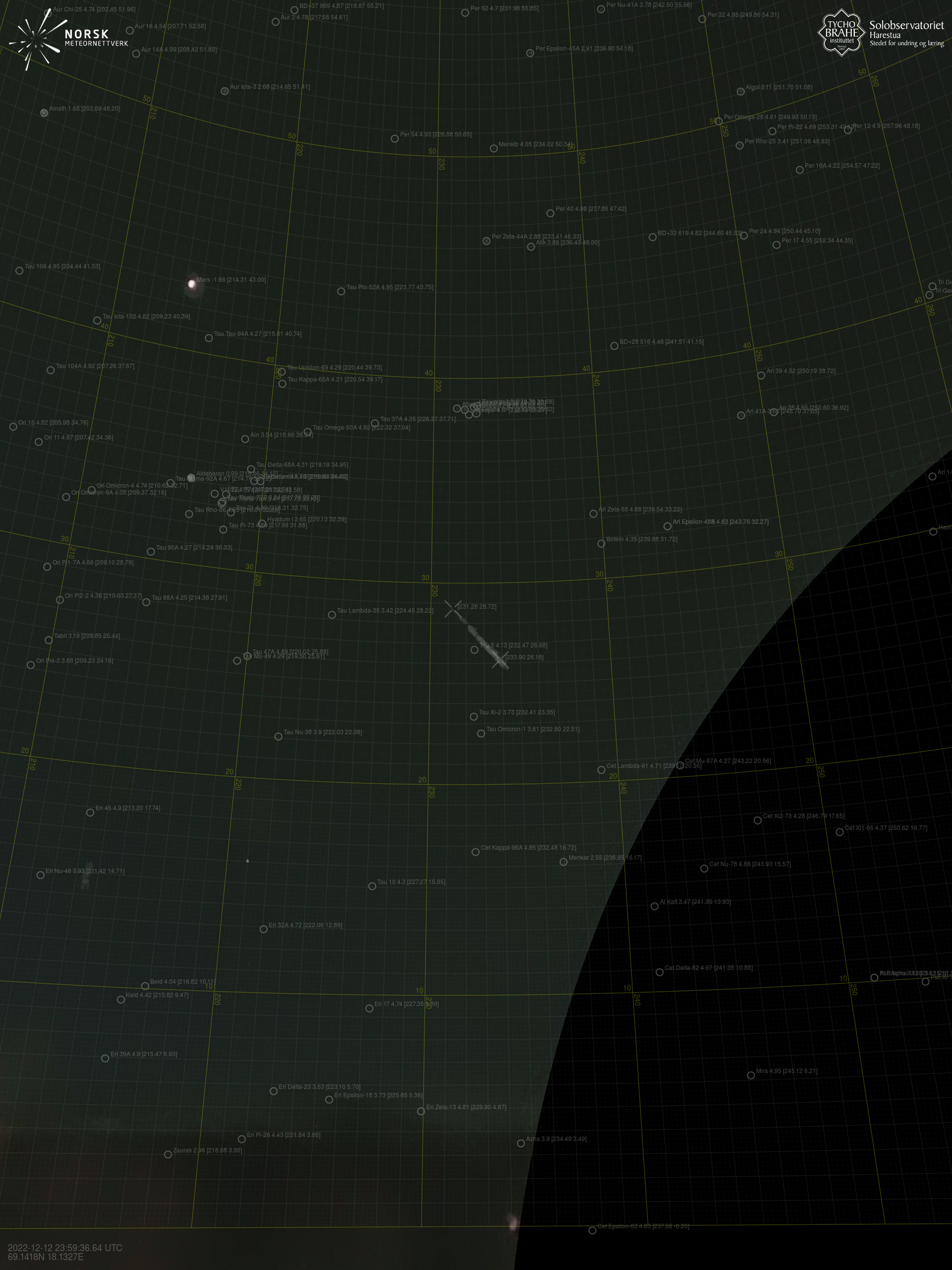
Sørreisa – 1
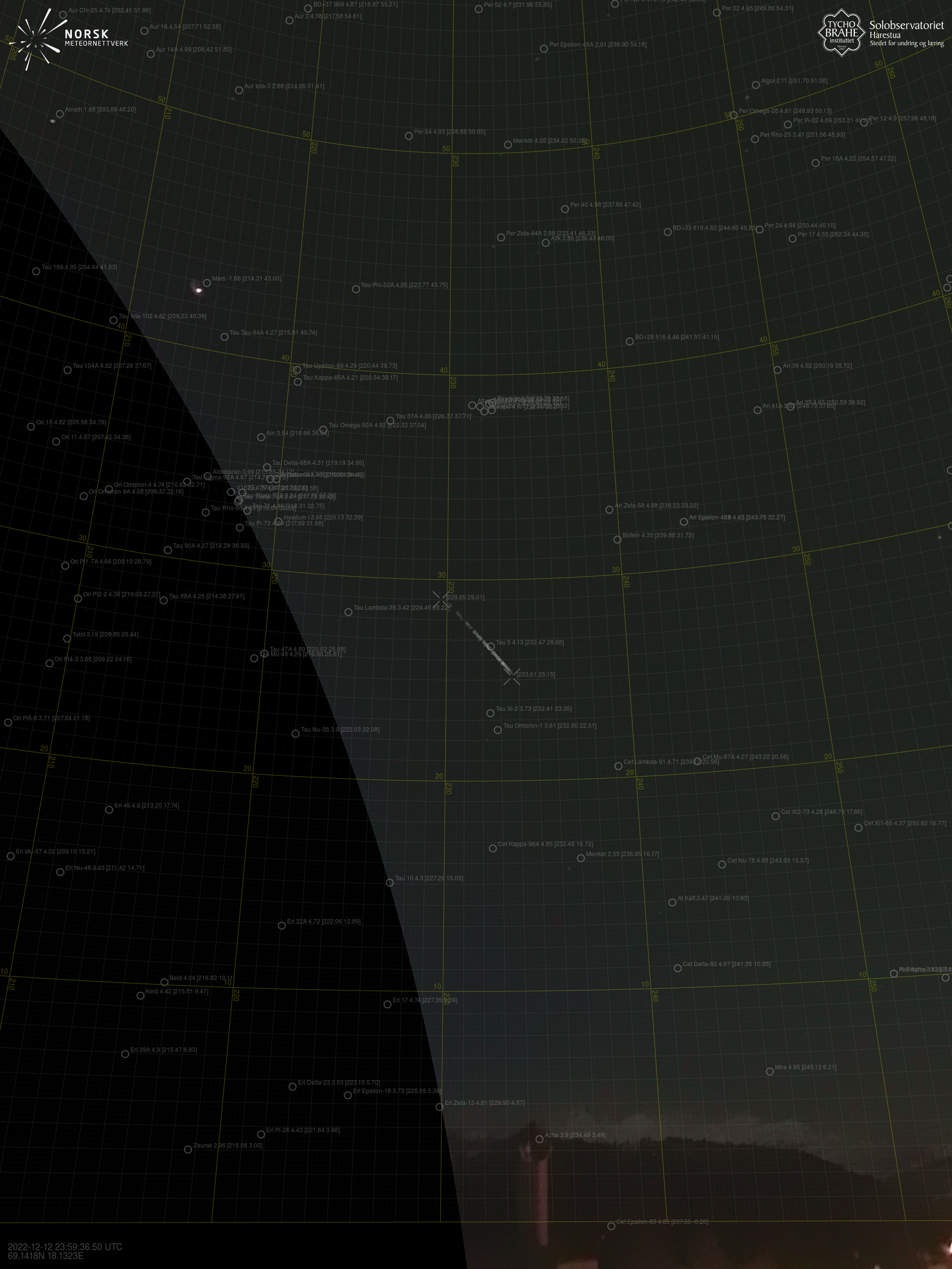
Sørreisa – 3
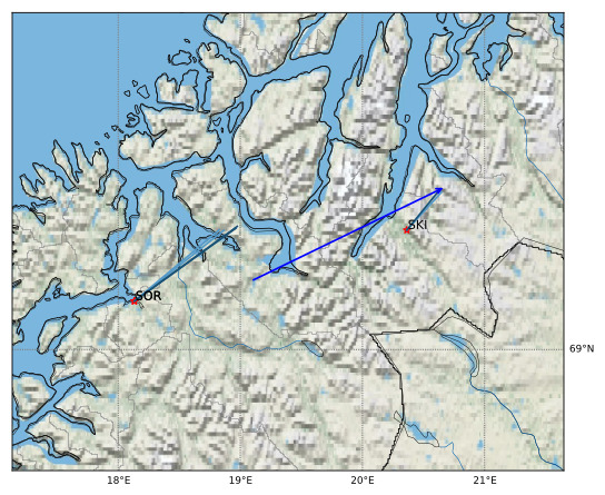
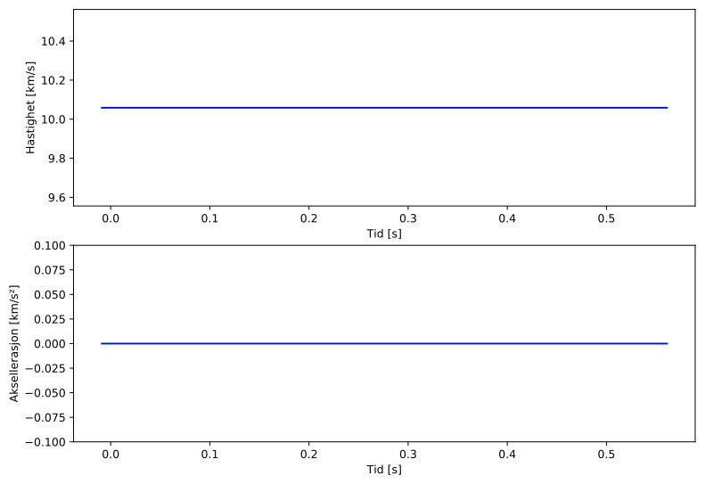
Meteorens atmosfæriske bane:
ImagesText Files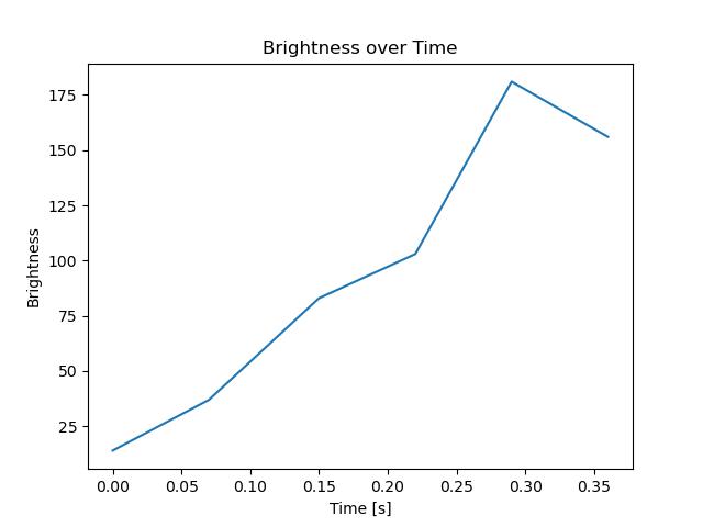
ImagesText Files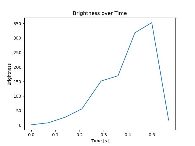
|
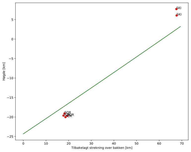
Meteorens atmosfæriske bane:
ImagesText Files
ImagesText Files
|