🇳🇴
🇬🇧
🇩🇪
🇨🇿
🇫🇮
Meteor over Trysil
2024-11-07
01:38:10 UTC
Finnskogen – 1
Finnskogen – 5
KML file
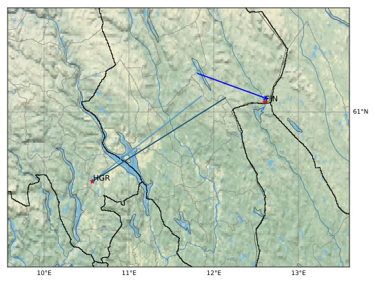
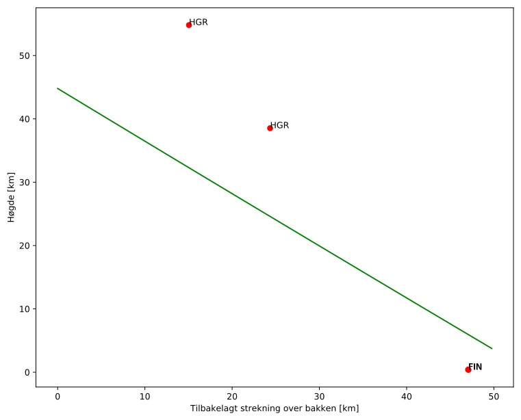
Meteorens atmosfæriske bane
:
Starthøgde:
44,8 km
Slutthøgde:
3,7 km
Startposisjon:
61,223N 11,793E
Sluttposisjon:
61,070N 12,665E
Retning:
109,6°
Fallvinkel:
39,6°
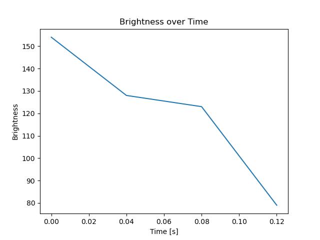
Inngangshastighet:
0,3 km/s
Finnskogen – 1
Finnskogen – 5
Videos
Gnomonic
Gnomonic with coordinates
Original
Images
Gnomonic
Gnomonic with coordinates
Uncorrected gnomonic with coordinates
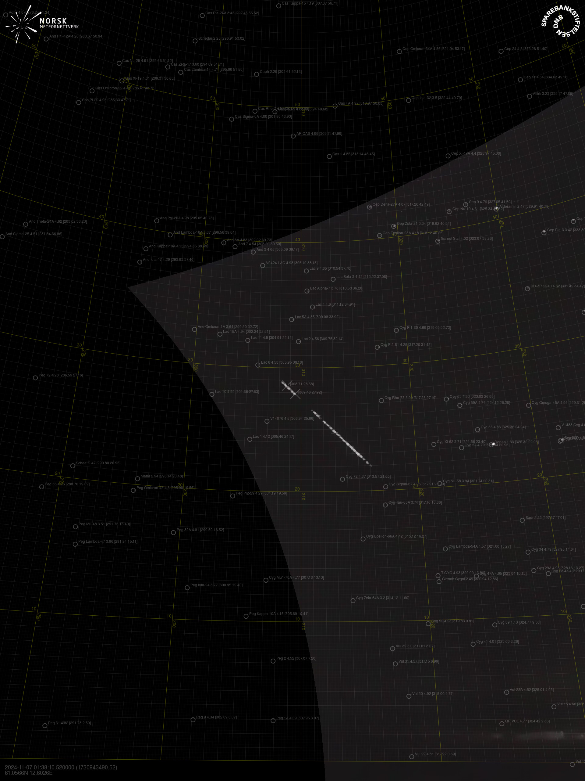
Gnomonic with labels
Uncorrected gnomonic with labels
Original
Original with coordinates
Text Files
Detection
Observation
Coordinates
Log
Videos
Gnomonic
Gnomonic with coordinates
Original
Images
Gnomonic
Gnomonic with coordinates
Uncorrected gnomonic with coordinates
Gnomonic with labels
Uncorrected gnomonic with labels
Original
Original with coordinates
Text Files
Detection
Observation
Coordinates
Log