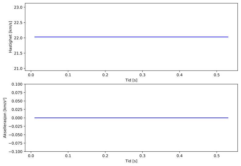
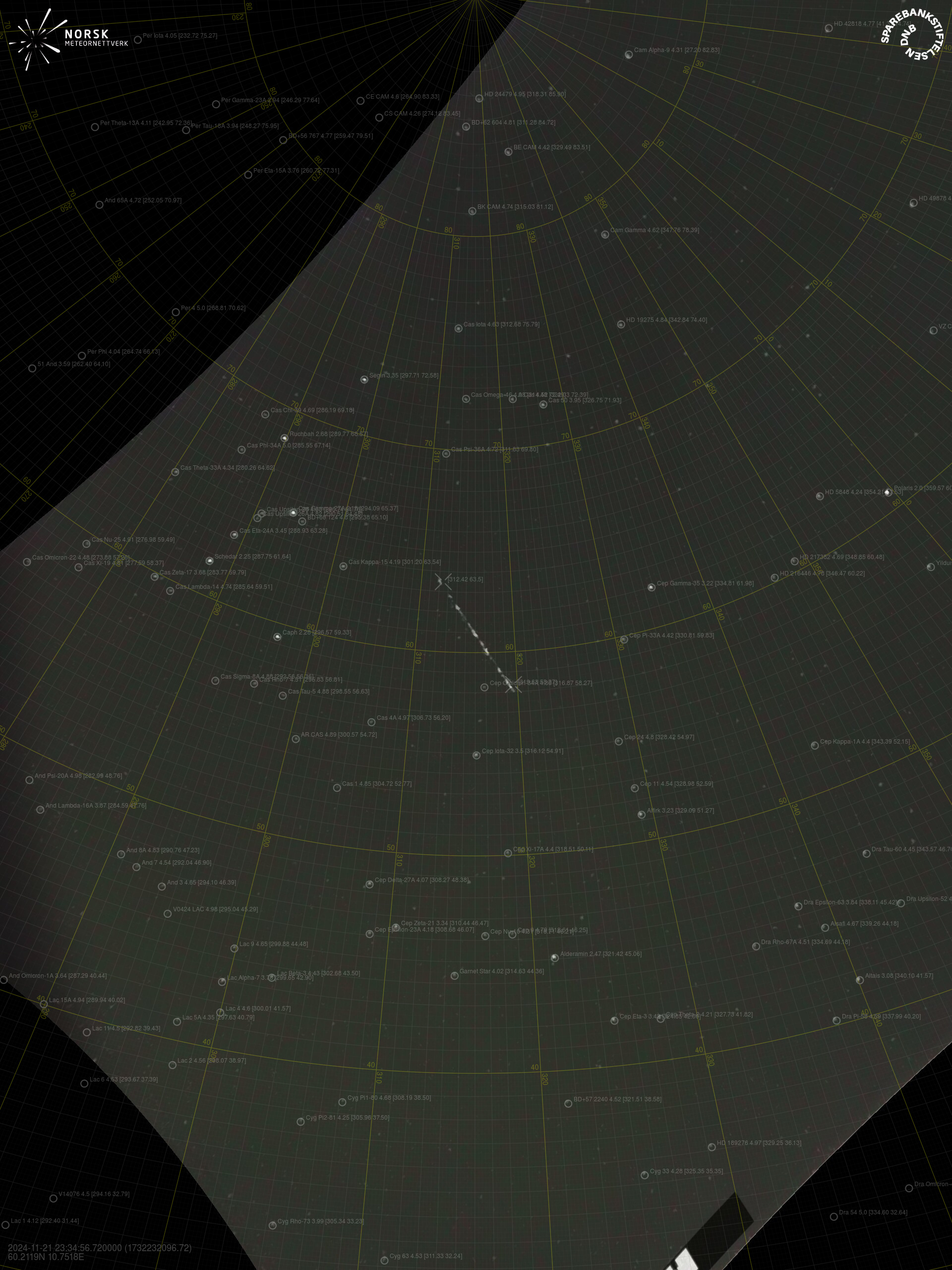
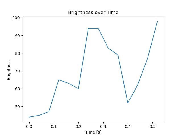
Meteorens atmosfæriske bane:
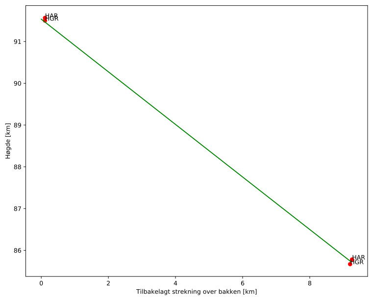
| Starthøgde: | 91,5 km |
| Slutthøgde: | 85,7 km |
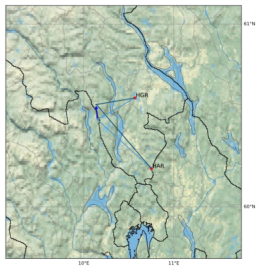
| Startposisjon: | 60,481N 10,150E |
| Sluttposisjon: | 60,564N 10,138E |
| Retning: | 355,9° |
| Fallvinkel: | 32,1° |
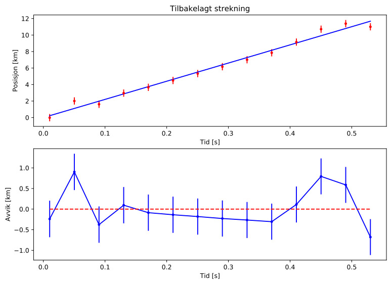
| Inngangshastighet: | 22,0 km/s |
| Radiantens rektascensjon: | 04:31 (67,9°) |
| Radiantens deklinasjon: | -2,0° |
| Meteorsverm: | sporadisk |
| Meteoroidens baneelement:
| Perihelavstand: | 0,600 AU |
| Eksentrisitet: | 0,578 |
| Inklinasjon: | 15,1° |
| Knutelengde: | 59,8° |
| Perihelargument: | 94,1° |
| Midlere anomali: | 330,0° |
| Epoke: | 2024 NOV 21 |
|