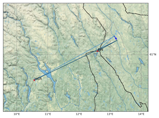
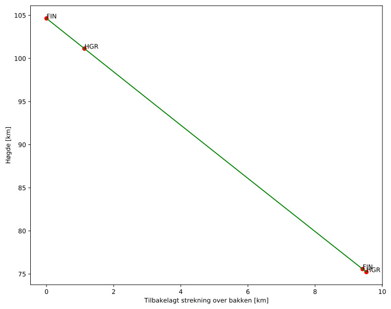
Meteorens atmosfæriske bane:
| Starthøgde: | 104,6 km |
| Slutthøgde: | 75,2 km |
| Startposisjon: | 61,295N 13,132E |
| Sluttposisjon: | 61,222N 13,226E |
| Retning: | 148,0° |
| Fallvinkel: | 72,0° |
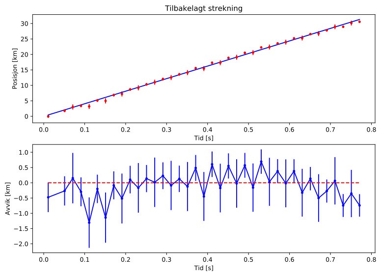
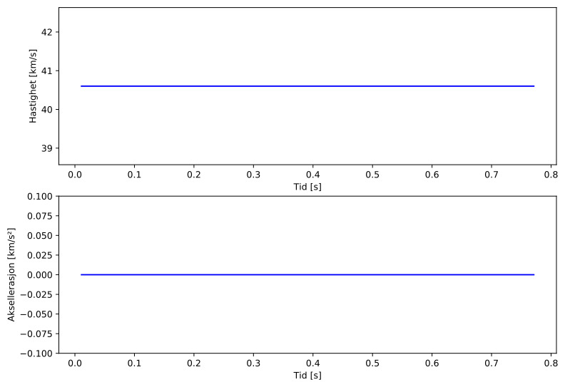
| Inngangshastighet: | 40,6 km/s |
| Radiantens rektascensjon: | 06:09 (92,4°) |
| Radiantens deklinasjon: | 73,6° |
| Meteorsverm: | sporadisk |
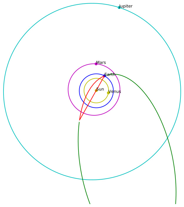
| Meteoroidens baneelement:
| Perihelavstand: | 0,693 AU |
| Eksentrisitet: | 0,920 |
| Inklinasjon: | 59,6° |
| Knutelengde: | 241,0° |
| Perihelargument: | 247,8° |
| Midlere anomali: | 358,6° |
| Epoke: | 2024 NOV 23 |
|