🇳🇴 🇬🇧 🇩🇪 🇨🇿 🇫🇮

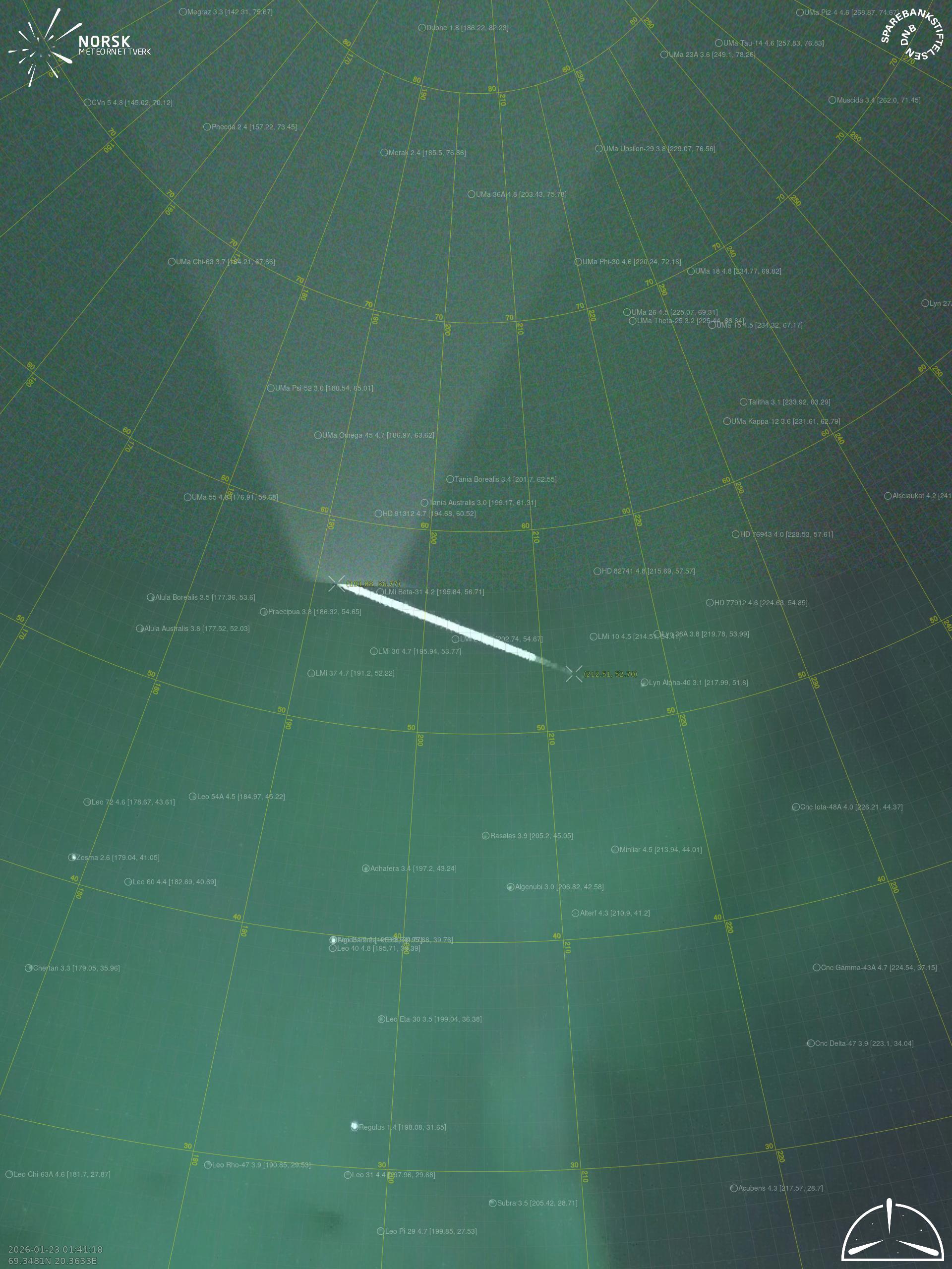
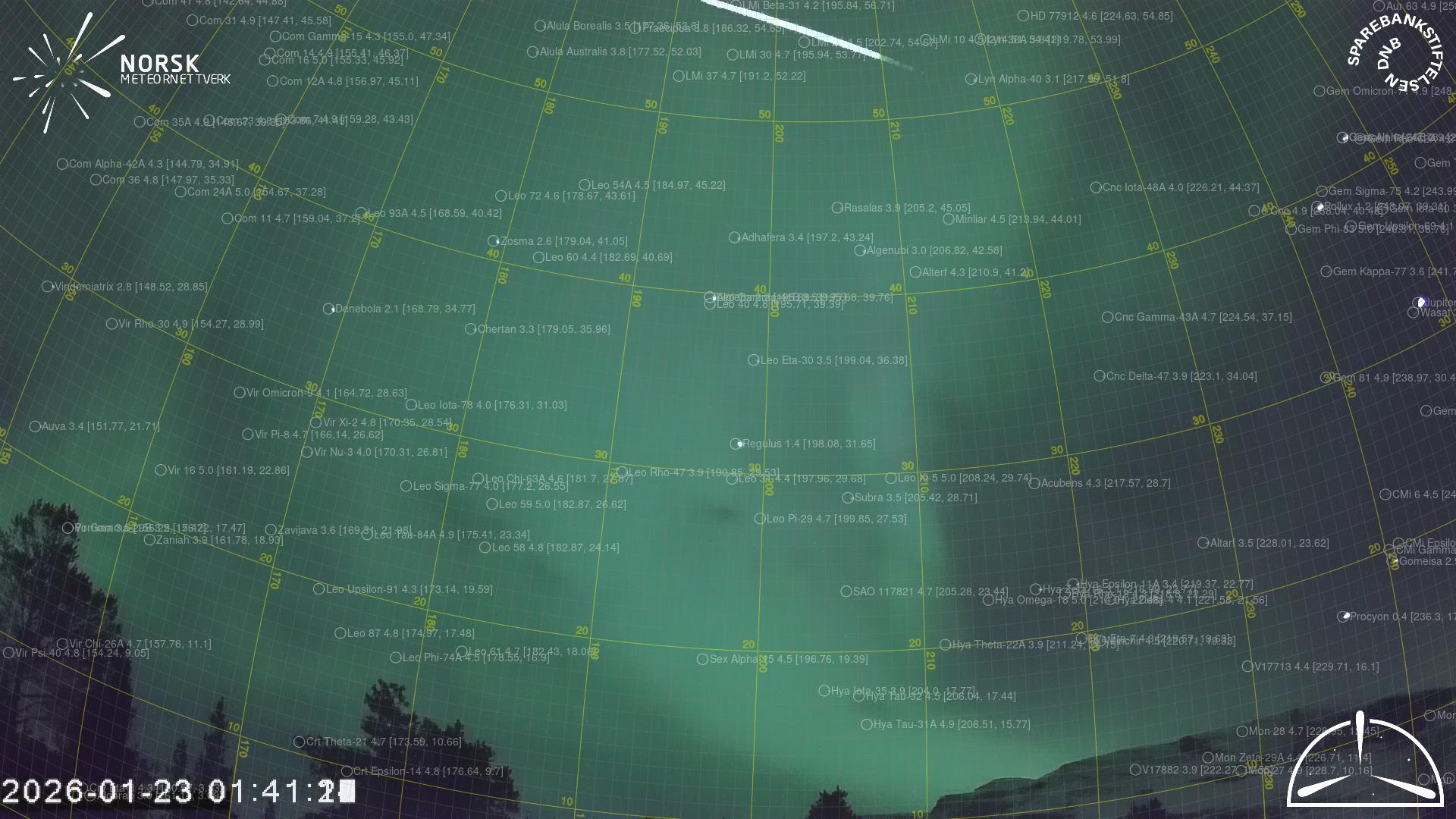
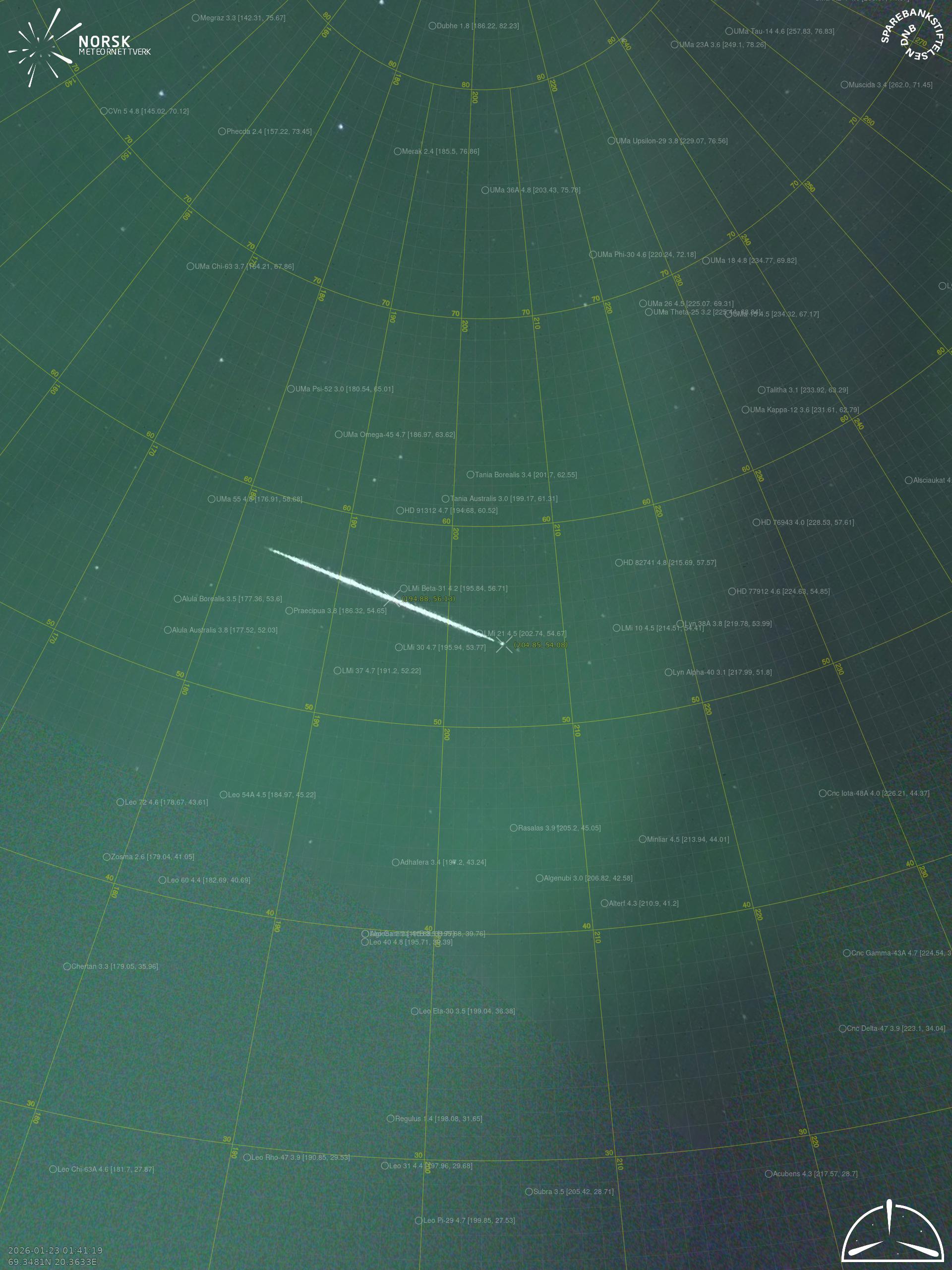
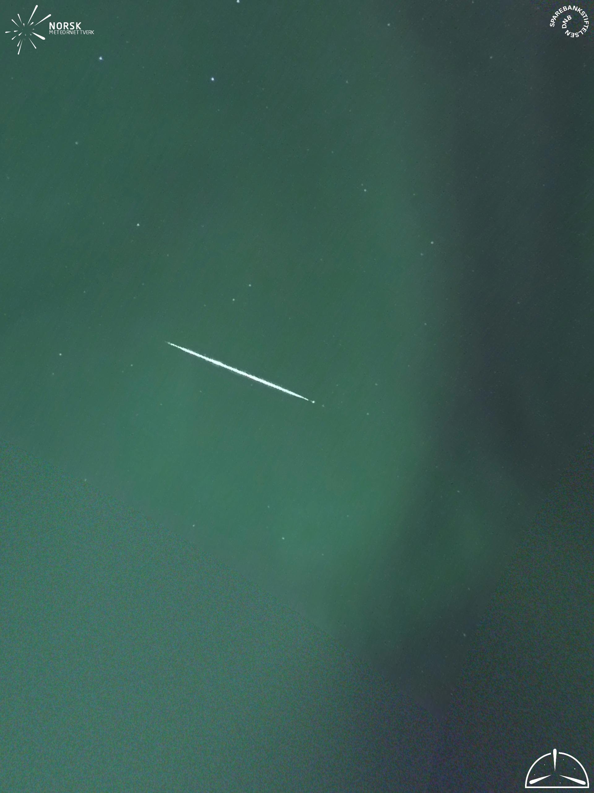
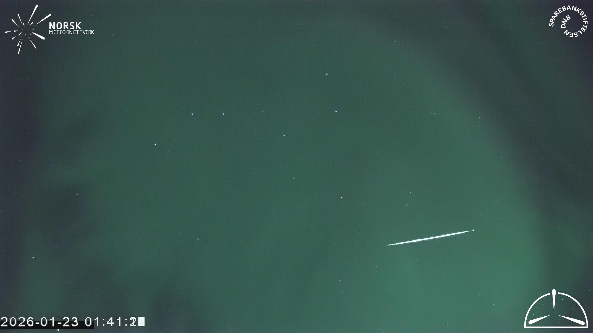
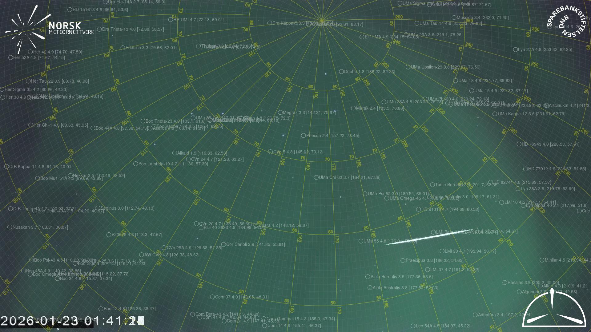
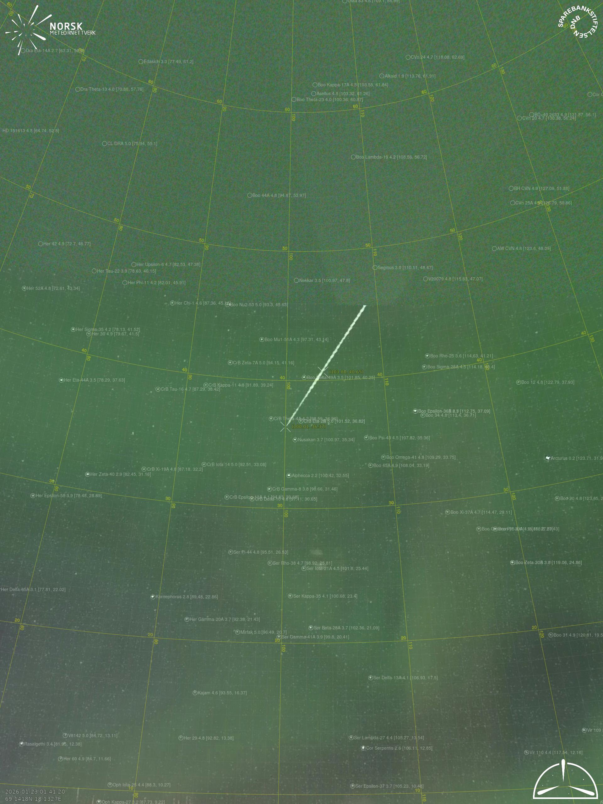
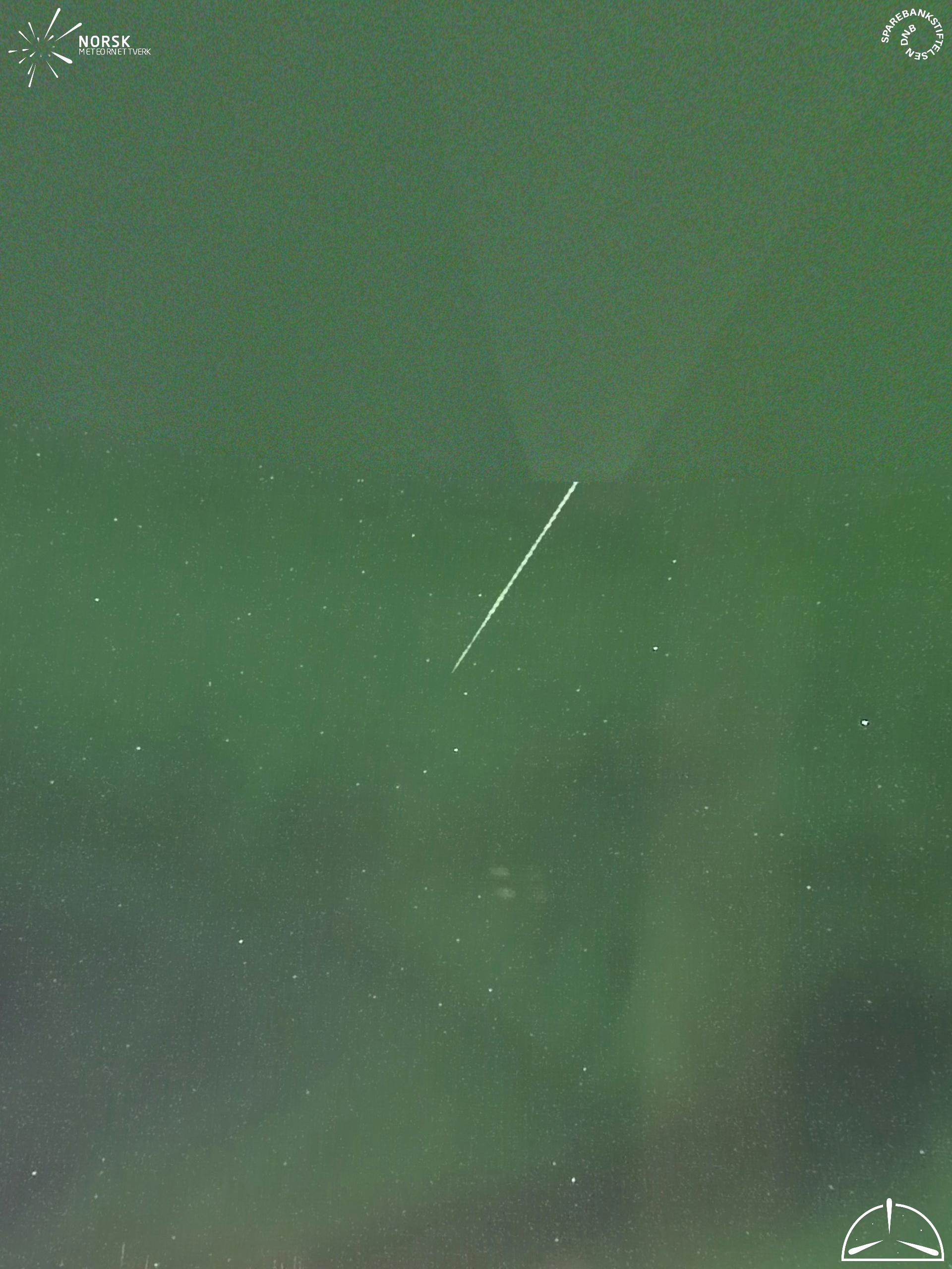
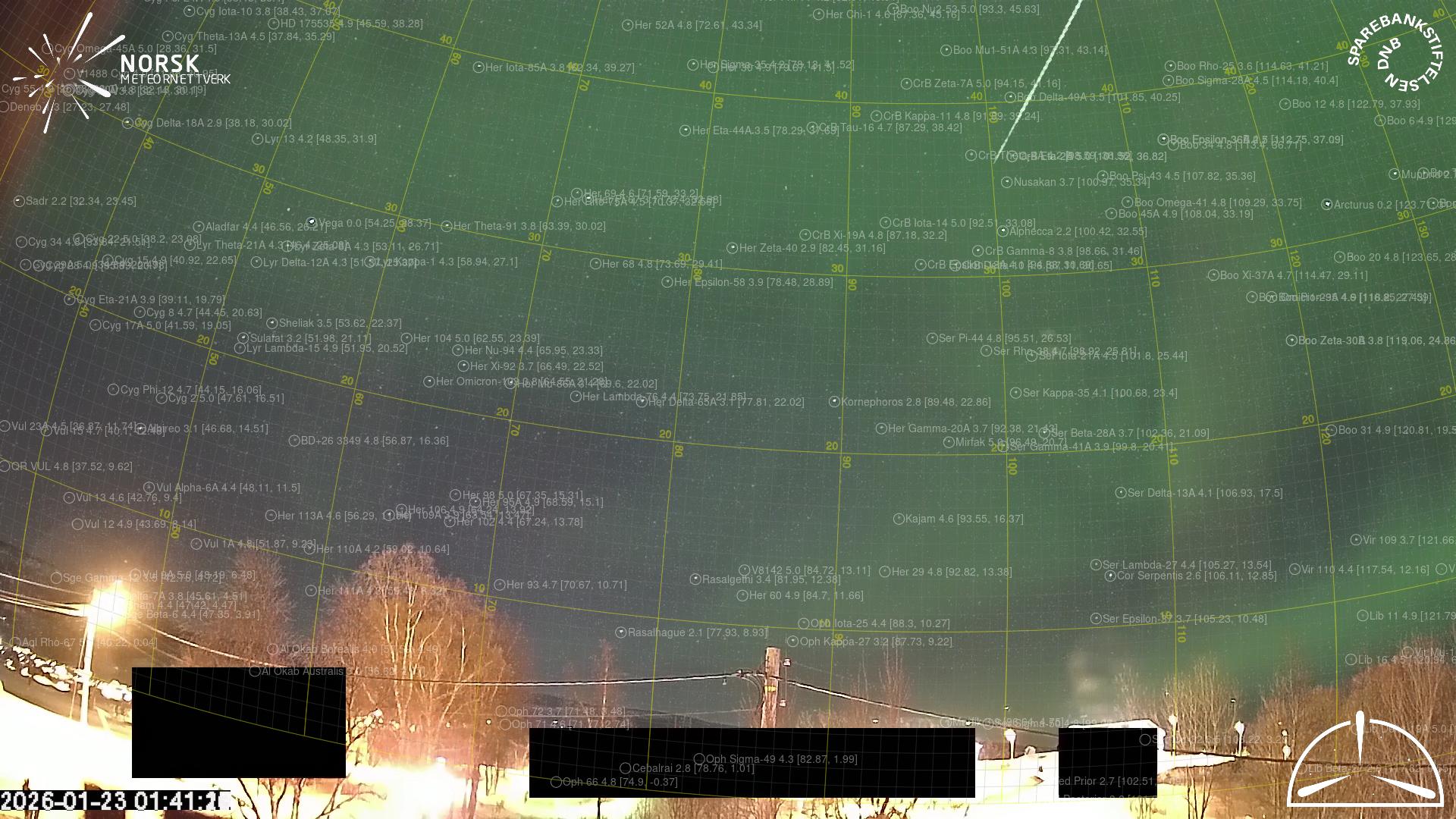
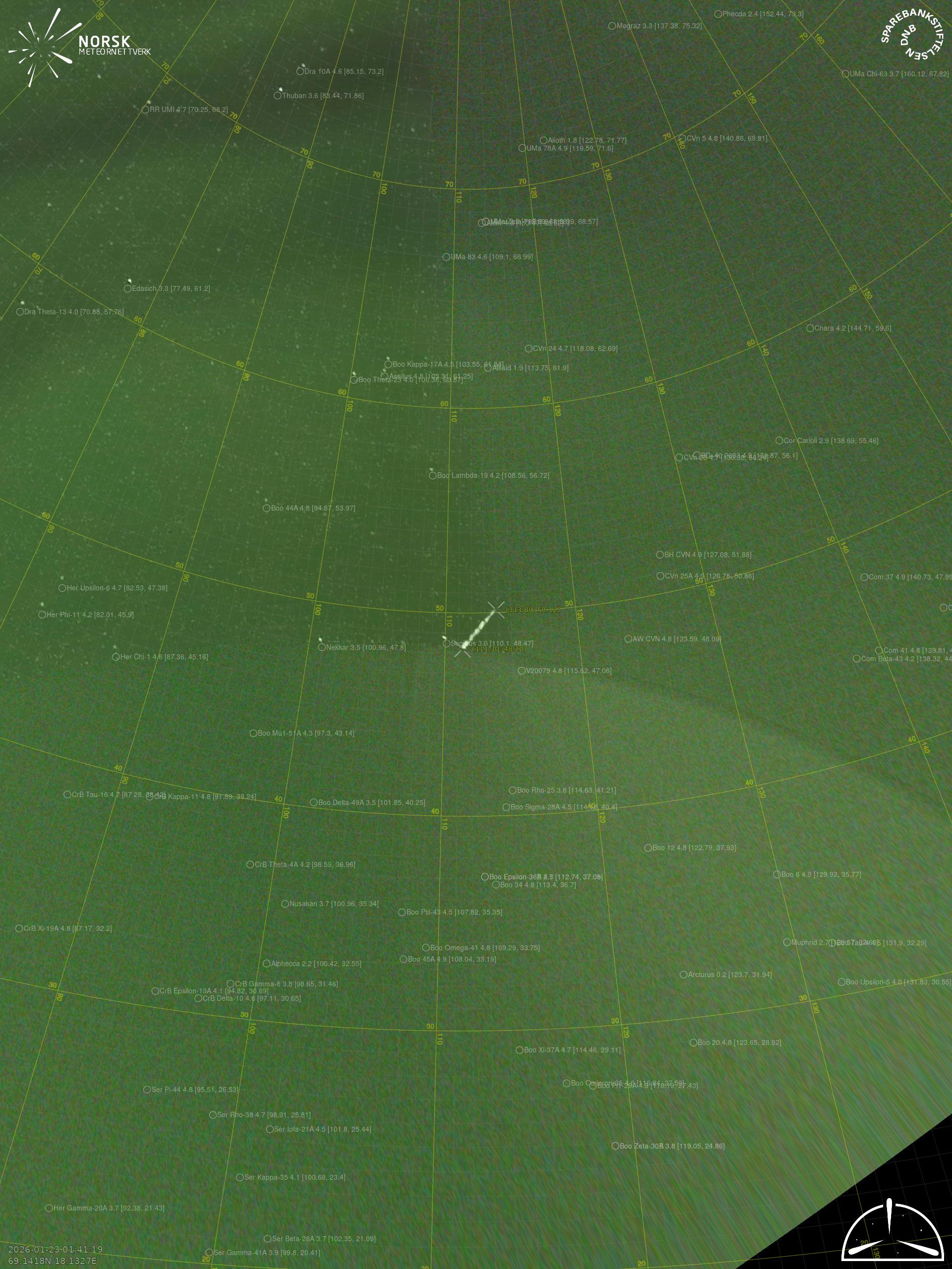
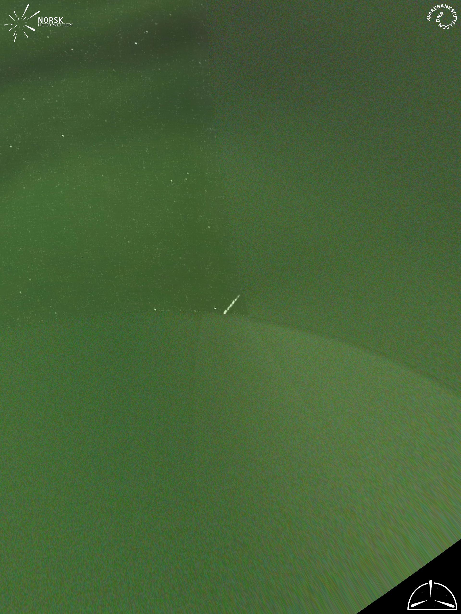
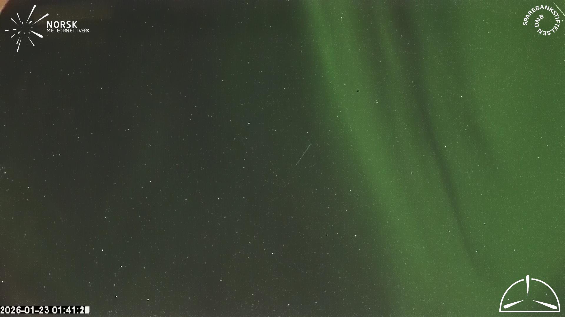
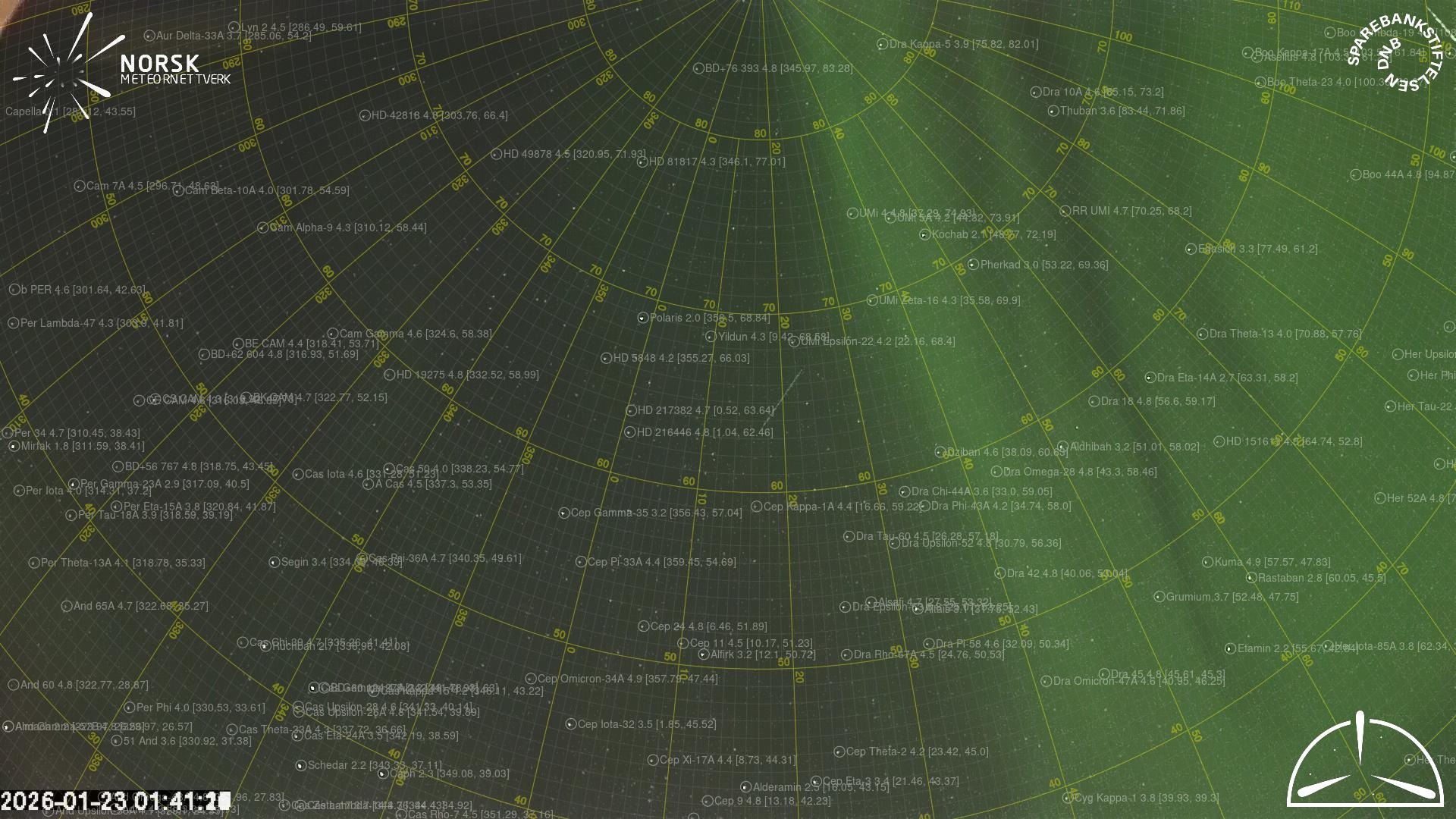
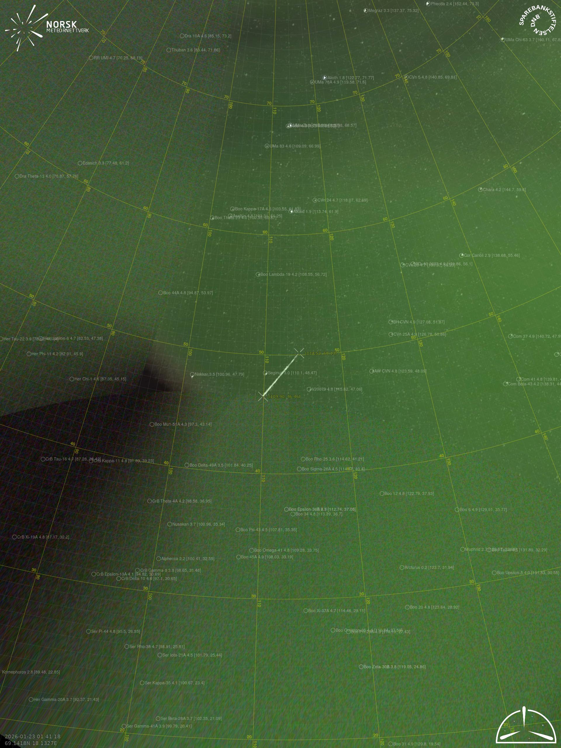
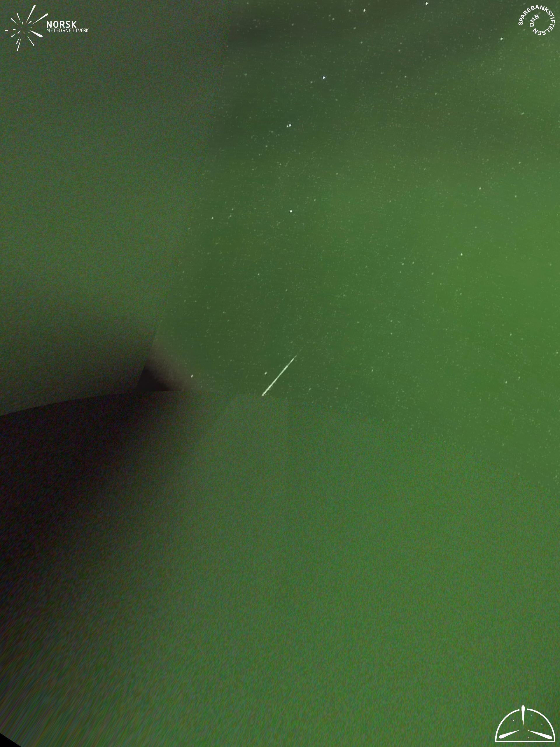
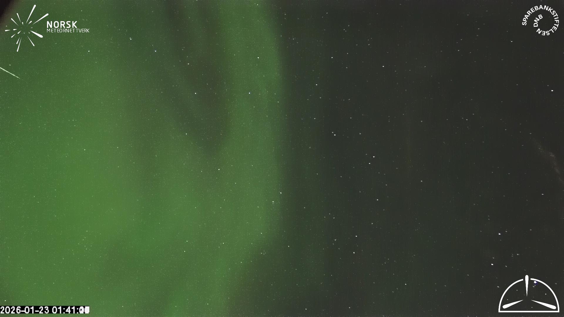
Meteor over Moen 2026-01-23 01:41:18 UTC

KML file  |  Interactive map

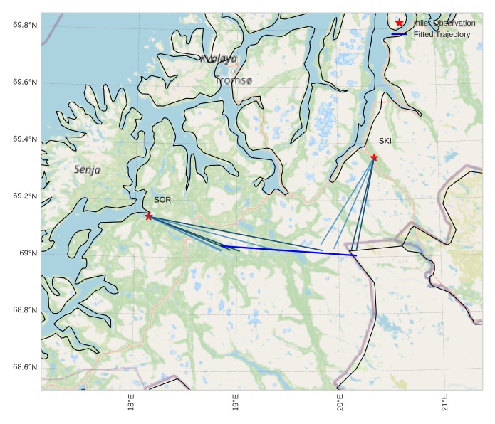
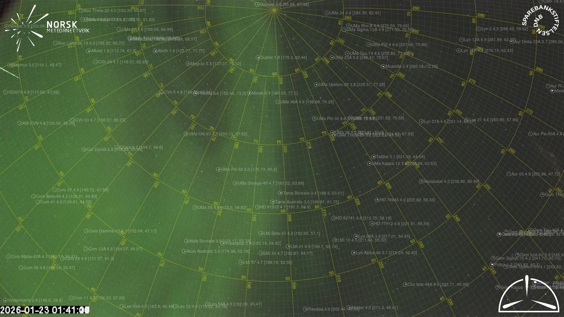
The map shows the bearings for the meteor. The lighter lines show the directions from the observation sites at the meteor's appearance, and the darker lines show where it was last seen. The blue arrow indicates the visible path of the meteor.

static map
height profile
wind profile
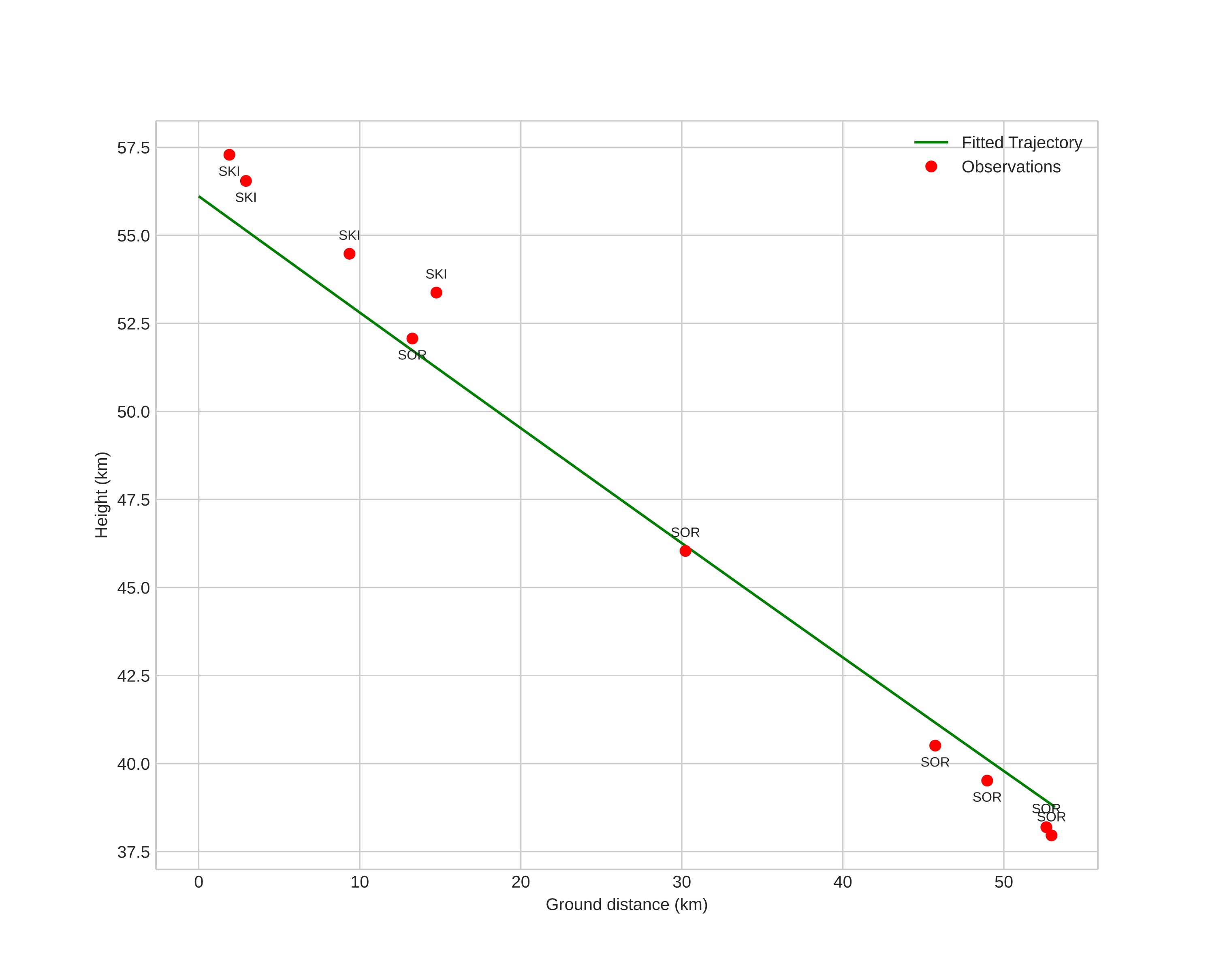
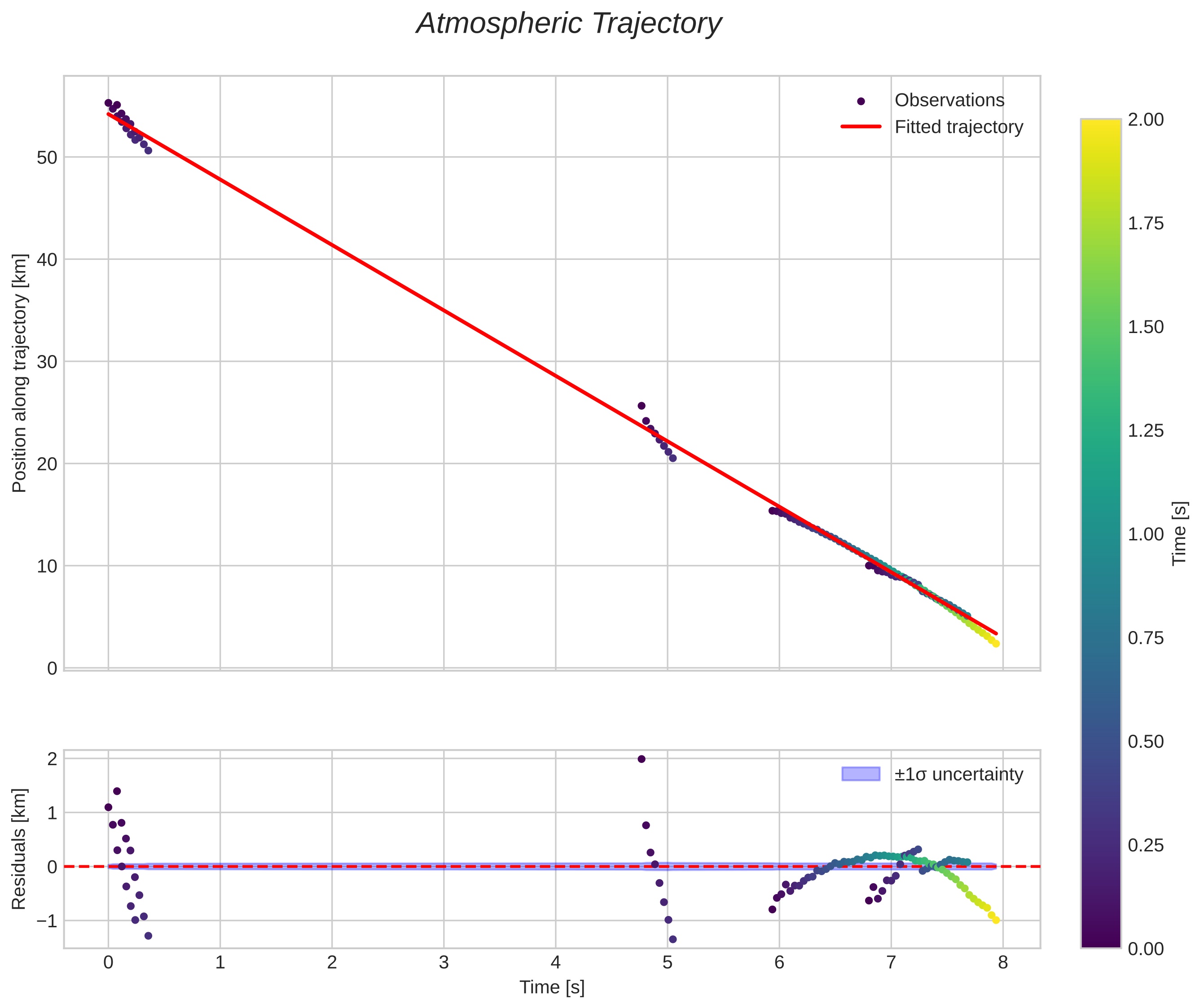
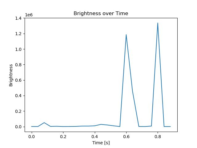
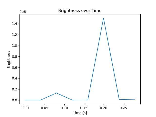
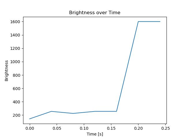
Meteor's Atmospheric Trajectory:
Start height: 56.1 km
End height: 38.8 km
Start position: 69.006N 20.178E
End position: 69.041N 18.846E
Direction: 274.9°
Inclination angle: 18.0°
orbit plot

Non-interactive plot | Interactive plot

position vs time
speed and acceleration

Skibotn (SKI) cam4


gnomonic
Videos
• Gnomonic
• Gnomonic with coordinates
• Original
• Original with coordinates
Images
• Gnomonic
• Gnomonic with coordinates
• Original
• Original with coordinates
Text Files
• Detection
• Observation
• Coordinates
• Log
Brightness

Skibotn (SKI) cam7


gnomonic
Videos
• Gnomonic
• Gnomonic with coordinates
• Original
• Original with coordinates
Images
• Gnomonic
• Gnomonic with coordinates
• Original
• Original with coordinates
Text Files
• Detection
• Observation
• Coordinates
• Log
Brightness

Sorreisa (SOR) cam2


gnomonic
Videos
• Gnomonic
• Gnomonic with coordinates
• Original
• Original with coordinates
Images
• Gnomonic
• Gnomonic with coordinates
• Original
• Original with coordinates
Text Files
• Detection
• Observation
• Coordinates
• Log
Brightness

Sorreisa (SOR) cam6


gnomonic
Videos
• Gnomonic
• Gnomonic with coordinates
• Original
• Original with coordinates
Images
• Gnomonic
• Gnomonic with coordinates
• Original
• Original with coordinates
Text Files
• Detection
• Observation
• Coordinates
• Log
Brightness

Sorreisa (SOR) cam7


gnomonic
Videos
• Gnomonic
• Gnomonic with coordinates
• Original
• Original with coordinates
Images
• Gnomonic
• Gnomonic with coordinates
• Original
• Original with coordinates
Text Files
• Detection
• Observation
• Coordinates
• Log
Brightness