🇳🇴 🇬🇧 🇩🇪 🇨🇿 🇫🇮

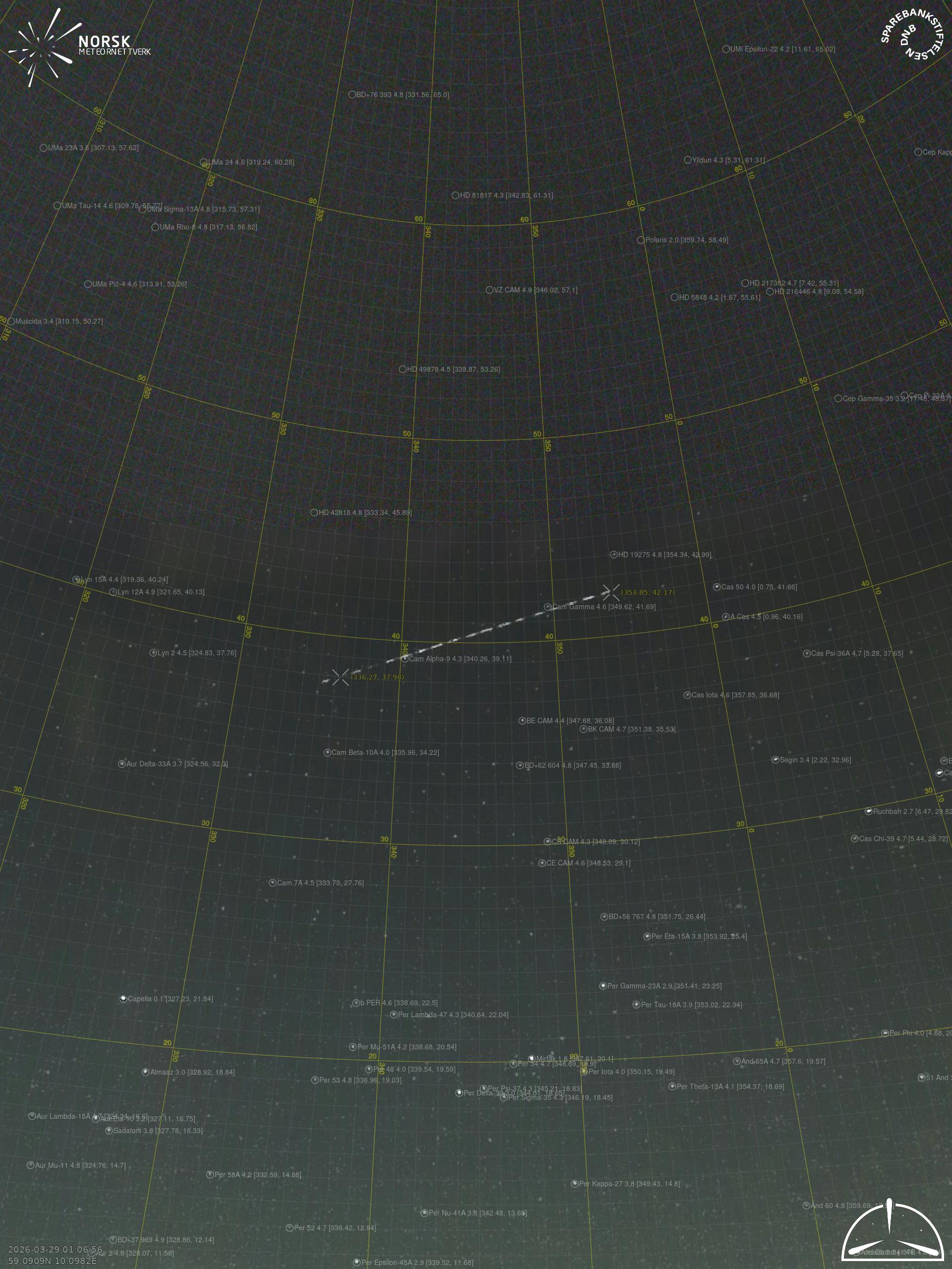
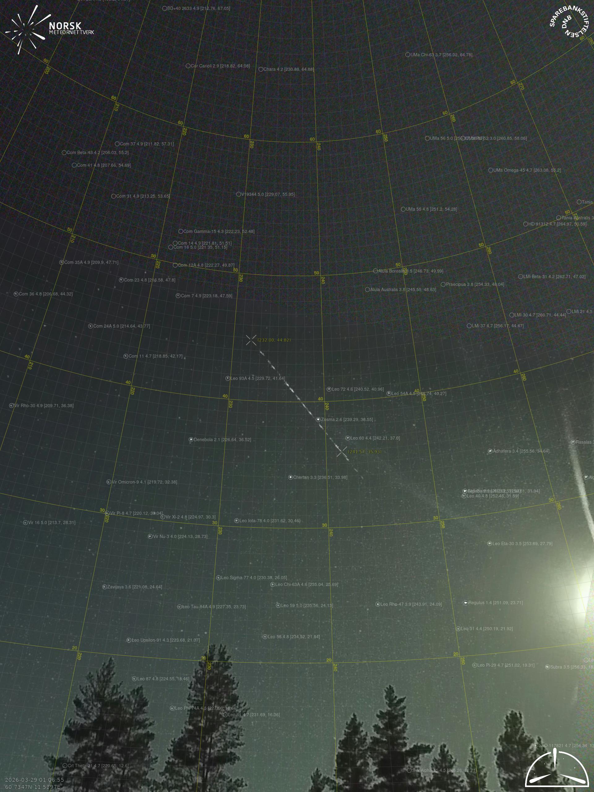
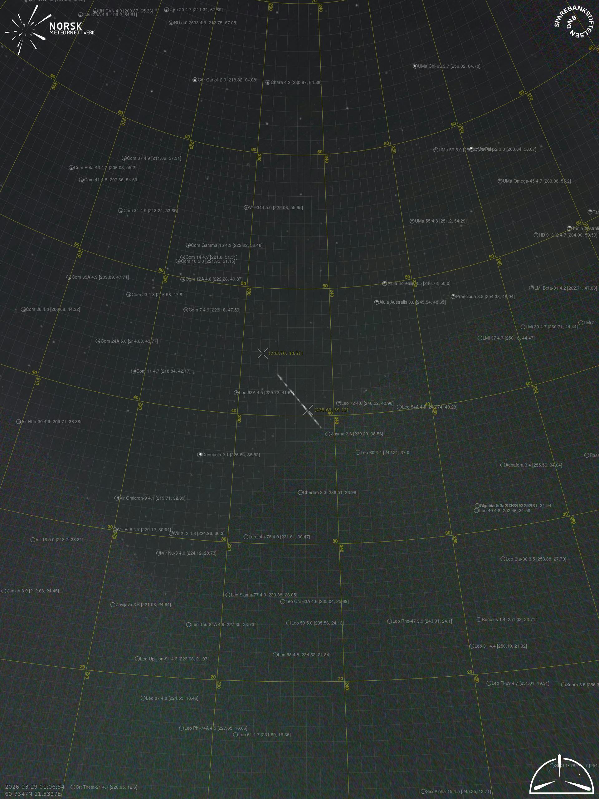
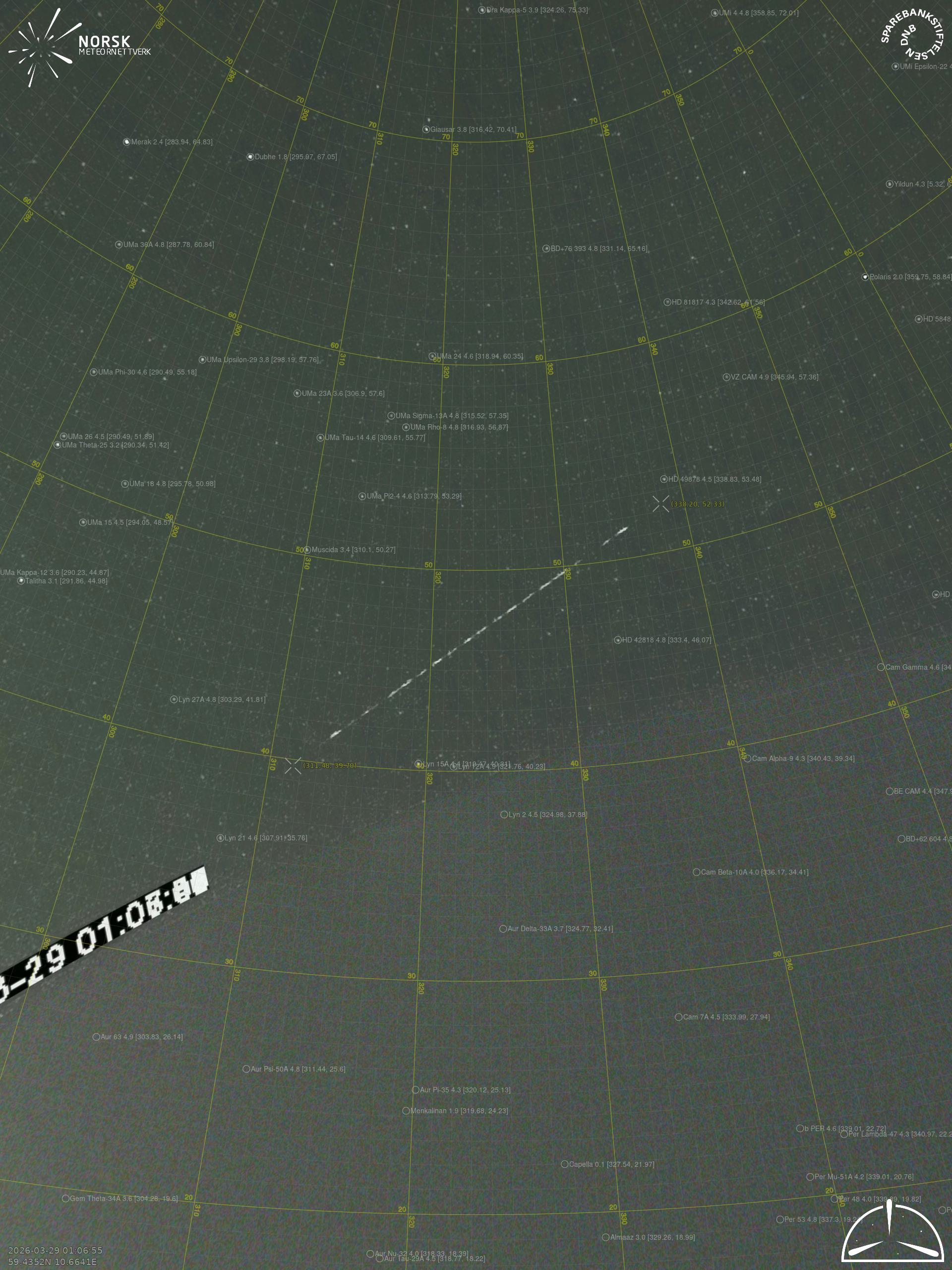
Meteor over Kirkenær 2026-03-29 01:06:55 UTC

KML-fil  |  Interaktivt kart

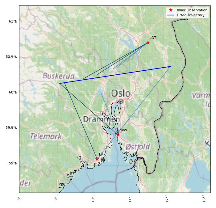
Kartet viser peilingene for meteoren. De lysere linjene viser retningene fra observasjonsstedene for meteorens tilsynekomst, og de mørkere linjene viser hvor den sist kunne sees. Den blå pila viser meteorens synlige ferd.

static map
height profile
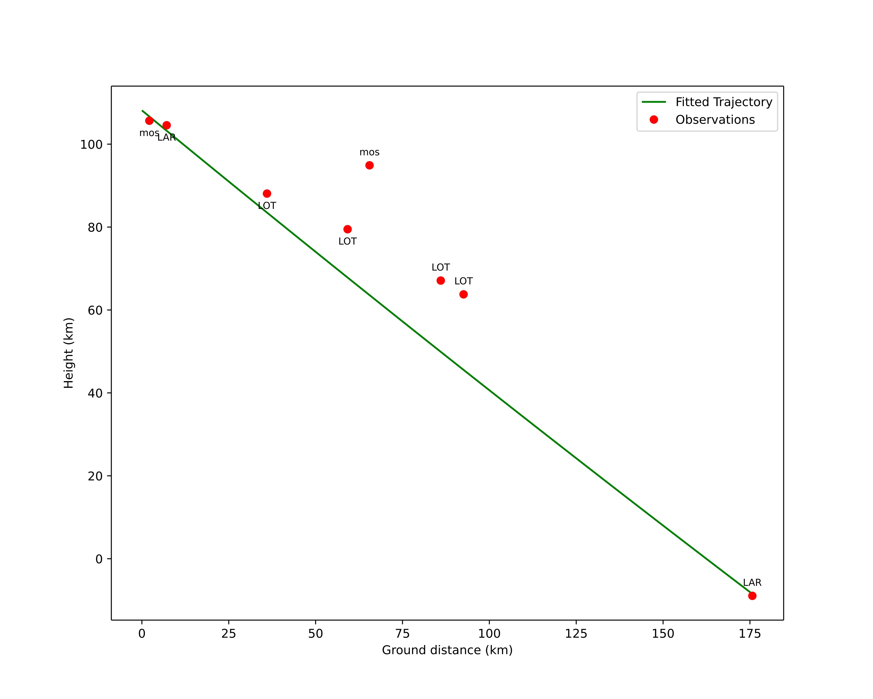
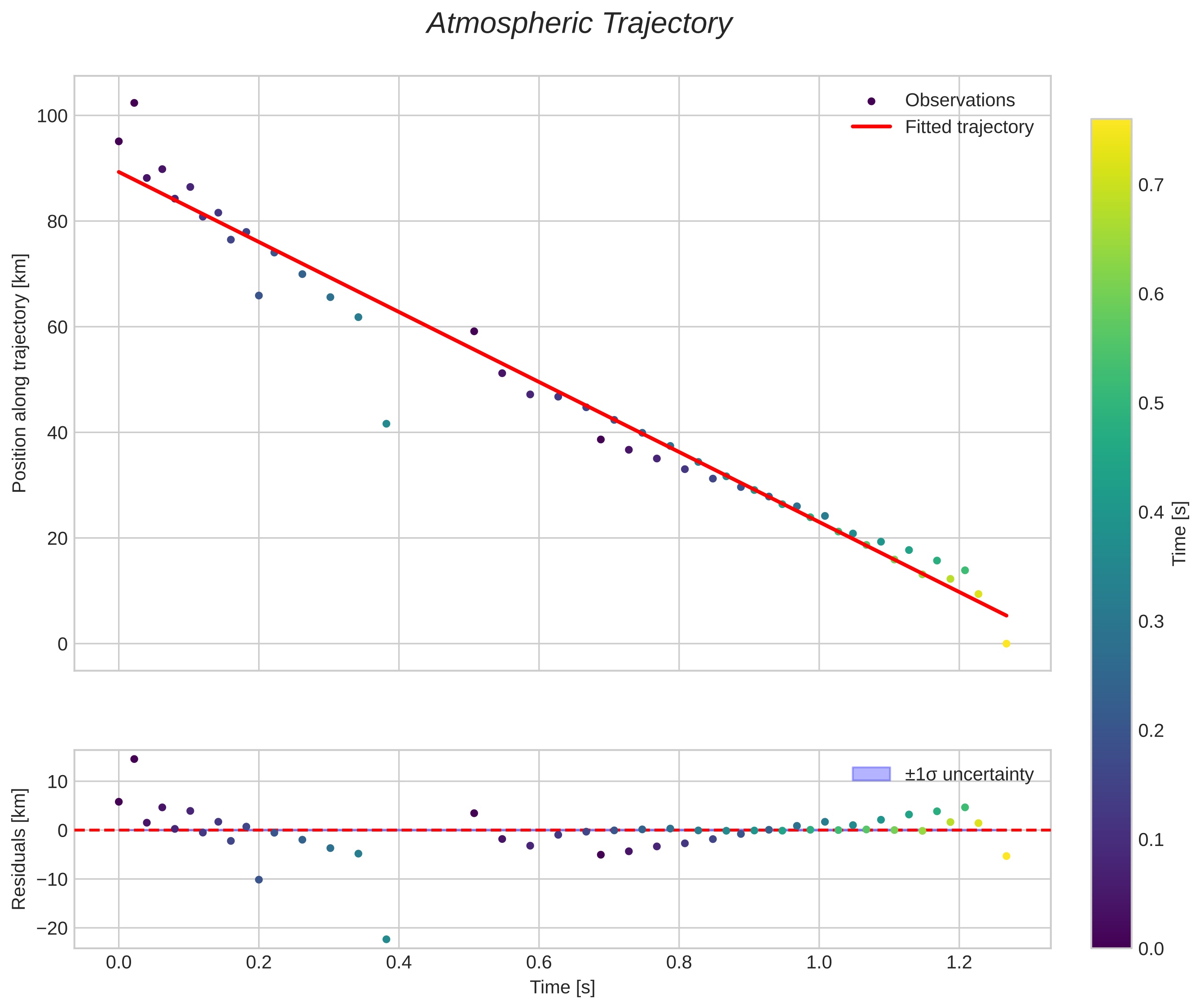
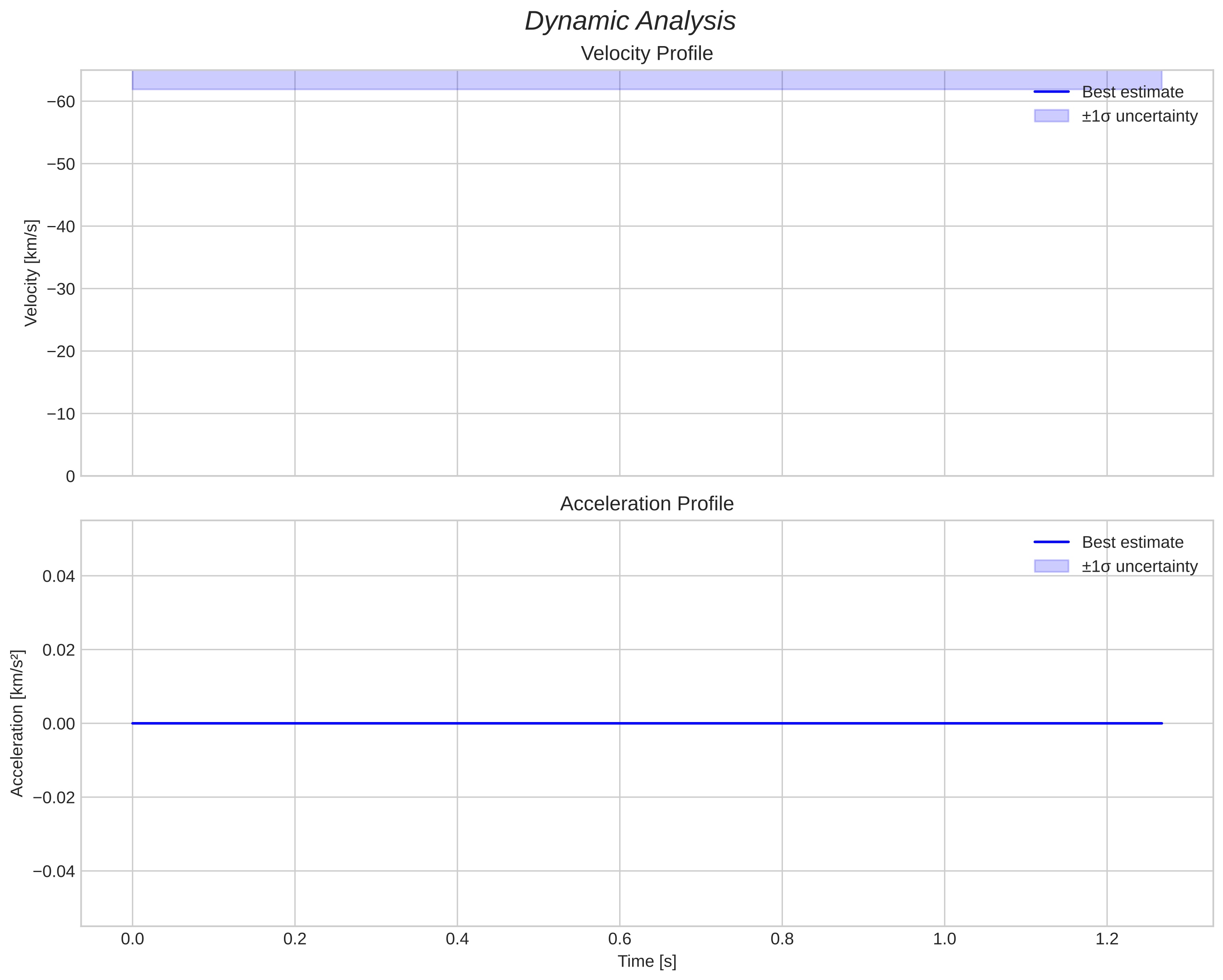
Meteor's Atmospheric Trajectory:
Start height: 108,1 km
End height: -8,6 km
Start position: 60,151N 9,027E
End position: 60,391N 12,181E
Direction: 79,9°
Inclination angle: 33,6°
orbit plot

Ikke-interaktivt plott | Interaktivt plott

position vs time
speed and acceleration

Larvik (LAR) cam1


preview
Videos:
• Gnomonic
• Gnomonic with coordinates
• Original
• Original with coordinates
Images:
• Gnomonic
• Gnomonic with coordinates
• Original
• Original with coordinates
Text Files:
• Detection
• Observation
• Coordinates
• Log
Brightness

Loten (LOT) cam4


preview
Videos:
• Gnomonic
• Gnomonic with coordinates
• Original
• Original with coordinates
Images:
• Gnomonic
• Gnomonic with coordinates
• Original
• Original with coordinates
Text Files:
• Detection
• Observation
• Coordinates
• Log
Brightness

Loten (LOT) cam7


preview
Videos:
• Gnomonic
• Gnomonic with coordinates
• Original
• Original with coordinates
Images:
• Gnomonic
• Gnomonic with coordinates
• Original
• Original with coordinates
Text Files:
• Detection
• Observation
• Coordinates
• Log
Brightness

Moss (mos) cam6


preview
Videos:
• Gnomonic
• Gnomonic with coordinates
• Original
• Original with coordinates
Images:
• Gnomonic
• Gnomonic with coordinates
• Original
• Original with coordinates
Text Files:
• Detection
• Observation
• Coordinates
• Log
Brightness