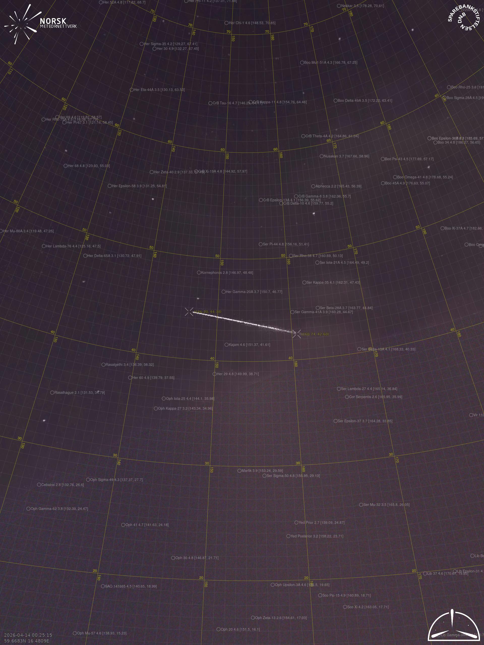
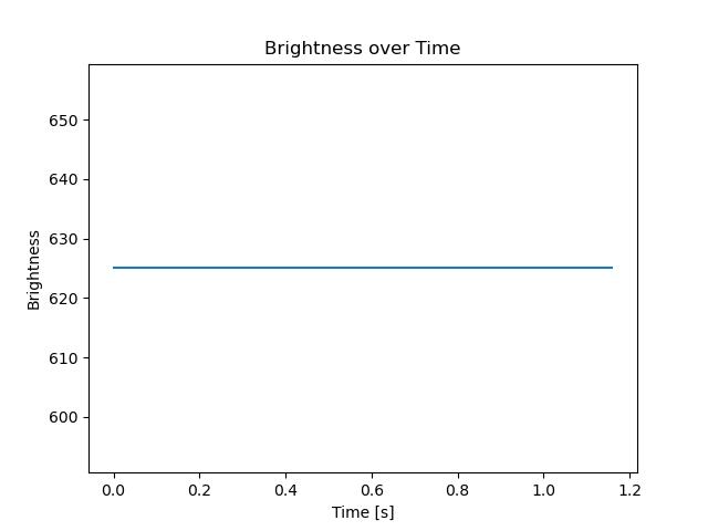
🇳🇴 🇬🇧 🇩🇪 🇨🇿 🇫🇮

Meteor over Fjellfoten 2026-04-14 00:25:08 UTC

KML file  |  Interactive map

The map shows the bearings for the meteor. The lighter lines show the directions from the observation sites at the meteor's appearance, and the darker lines show where it was last seen. The blue arrow indicates the visible path of the meteor.

static map
height profile
wind profile
Meteor's Atmospheric Trajectory:
Start height: 345.6 km
End height: -69.7 km
Start position: 57.771N 18.995E
End position: 60.102N 11.577E
Direction: 304.5°
Inclination angle: 39.8°
position vs time
speed and acceleration

Moss (mos) cam2


preview
Videos
• Gnomonic
• Gnomonic with coordinates
• Original
• Original with coordinates
Images
• Gnomonic
• Gnomonic with coordinates
• Original
• Original with coordinates
Text Files
• Detection
• Observation
• Coordinates
• Log
Brightness

Vasteras (VAS) cam7


preview
Videos
• Gnomonic
• Gnomonic with coordinates
• Original
• Original with coordinates
Images
• Gnomonic
• Gnomonic with coordinates
• Original
• Original with coordinates
Text Files
• Detection
• Observation
• Coordinates
• Log
Brightness