Theme:
Meteor over Vigeland 2026-10-19 03:16:06 UTC
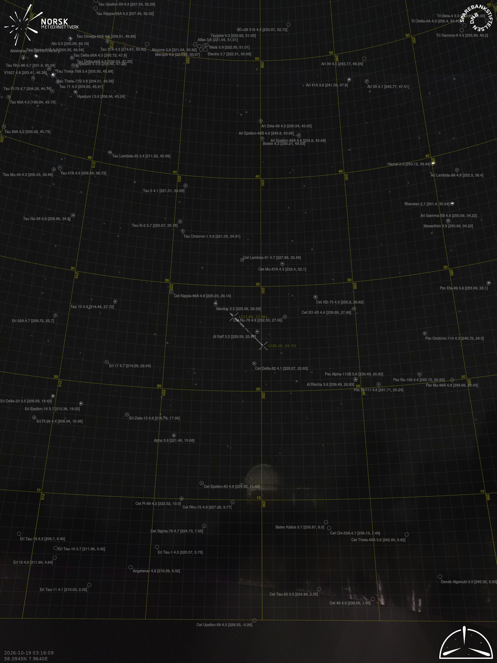
Kristiansand – 4
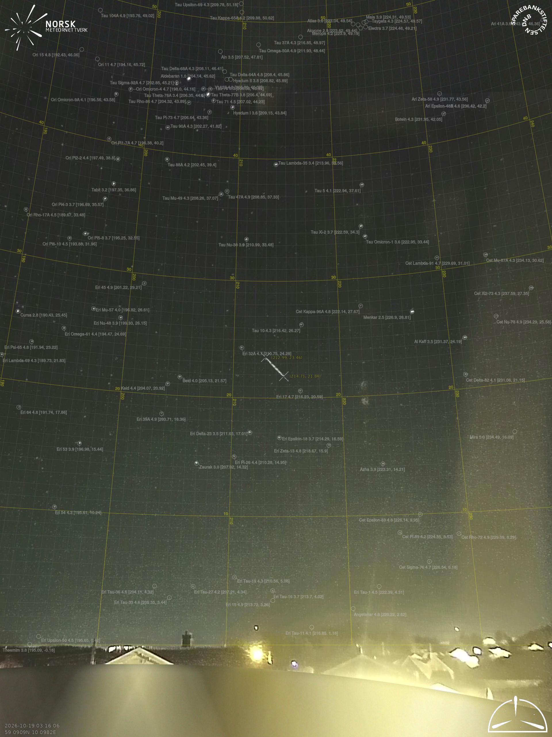
Larvik – 4
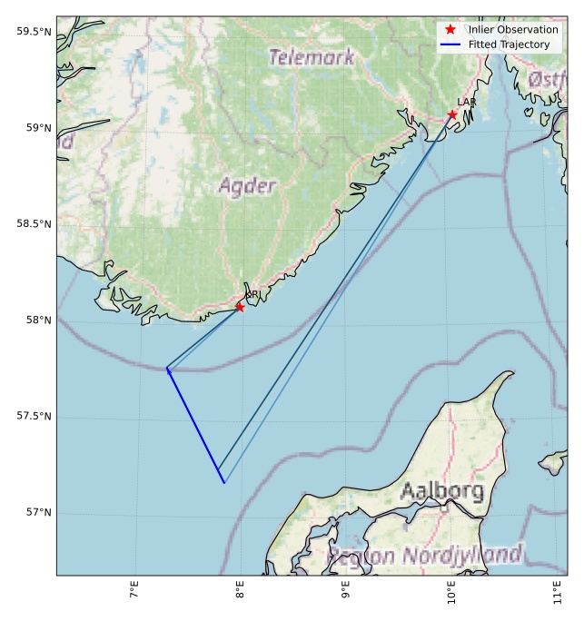
The map shows the bearings for the meteor. The lighter lines show the directions from the observation sites at the meteor's appearance, and the darker lines show where it was last seen. The blue arrow indicates the visible path of the meteor.
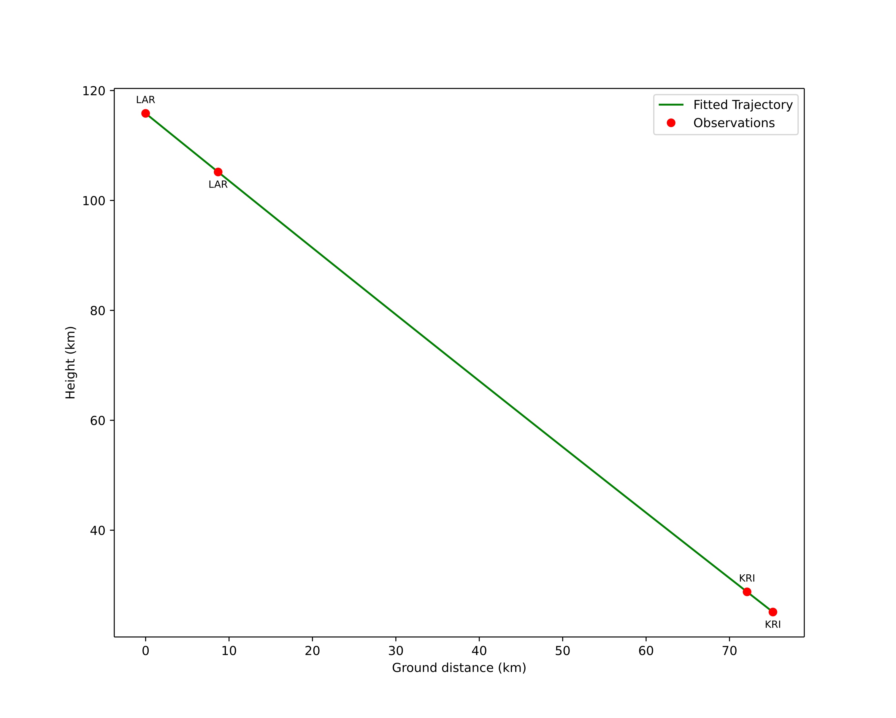
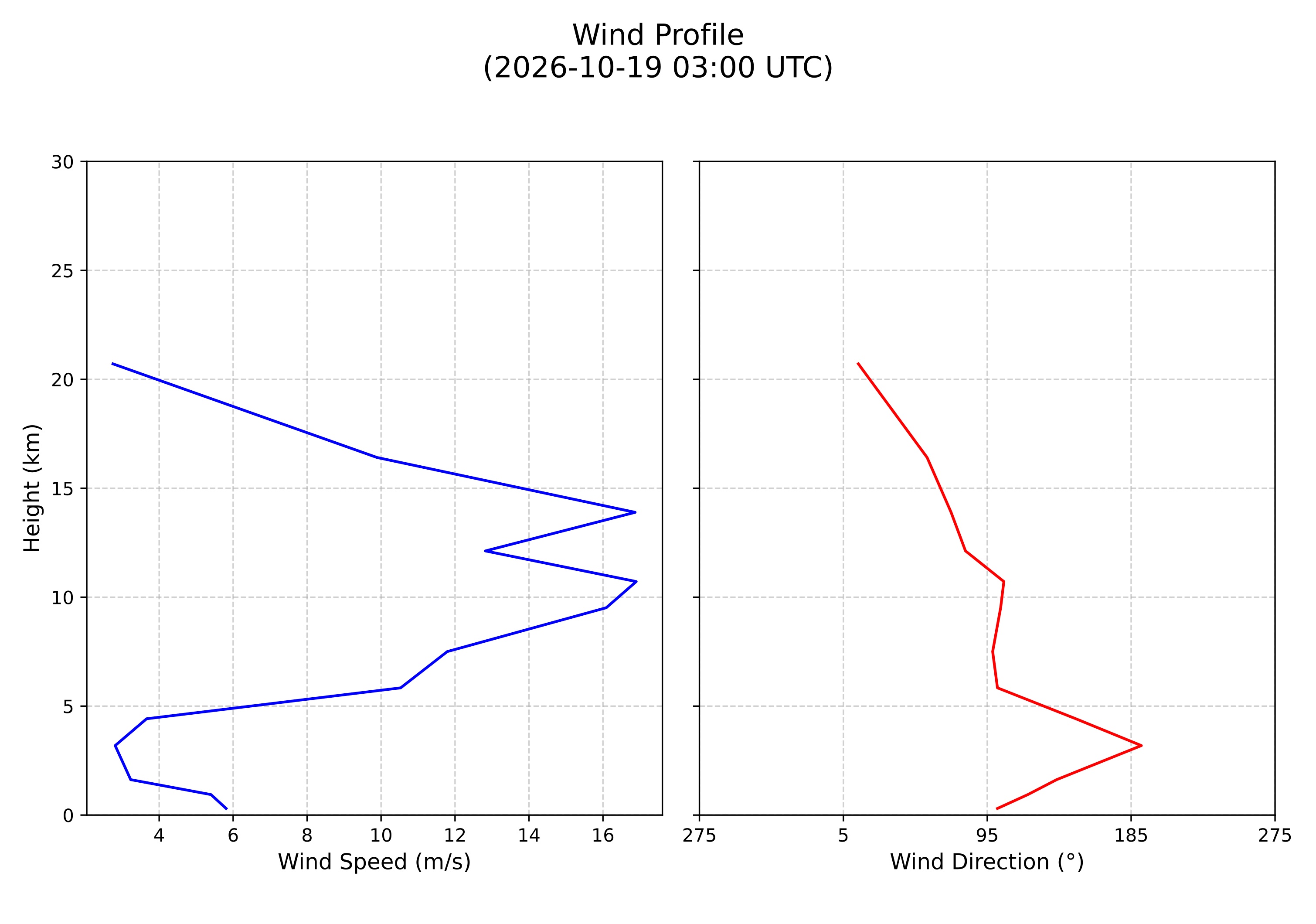
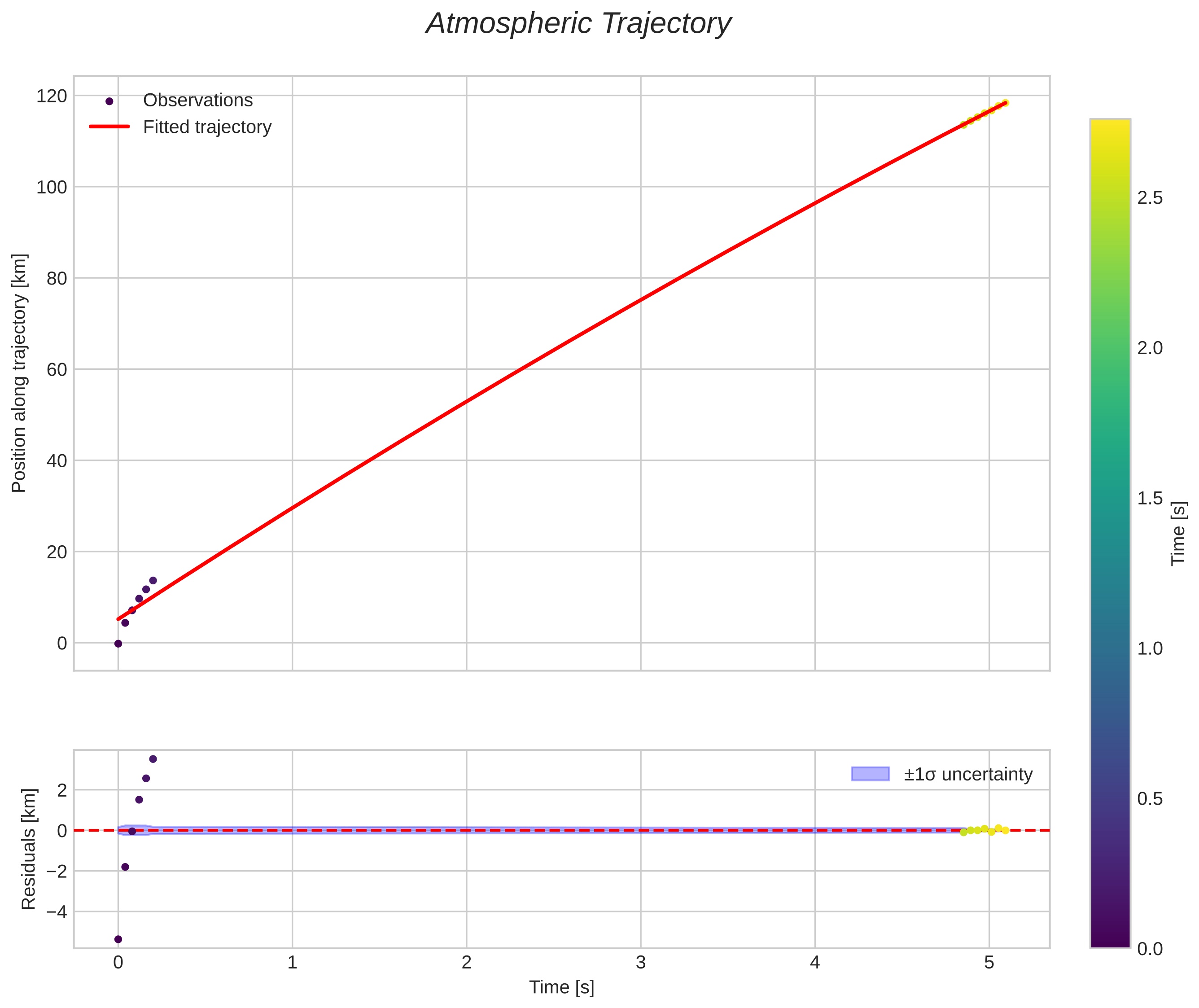
Meteor's Atmospheric Trajectory:
|
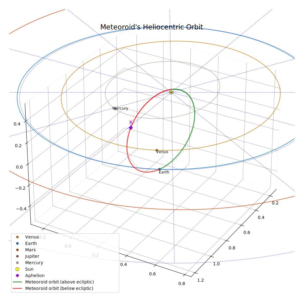
Meteoroid's Orbital Elements:
|
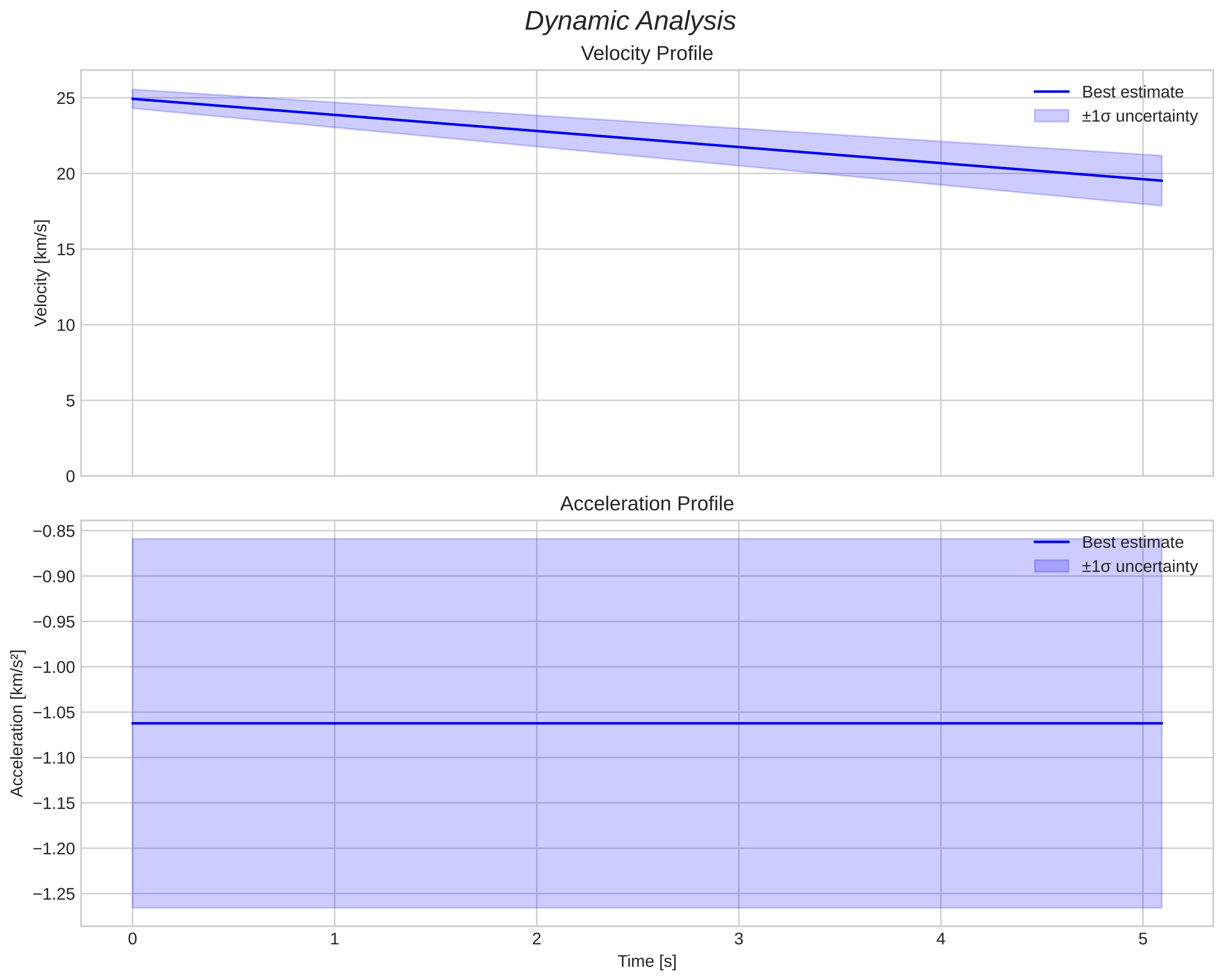
Dark flight
| End position: | 57.7769N 7.2549E, 25.1 km |
| End speed: | 19.5 km/s |
| Estimated entry mass: | ~258 mg (estimated) |
| Estimated surviving mass: | ~0 g (estimated) |
| Conditional fall area (MC): | 57.779-57.869N, 7.127-7.208E |
| Monte Carlo samples fragment masses evenly across the 5 g–5 kg range (logarithmic scale) at the end of luminous flight. | |
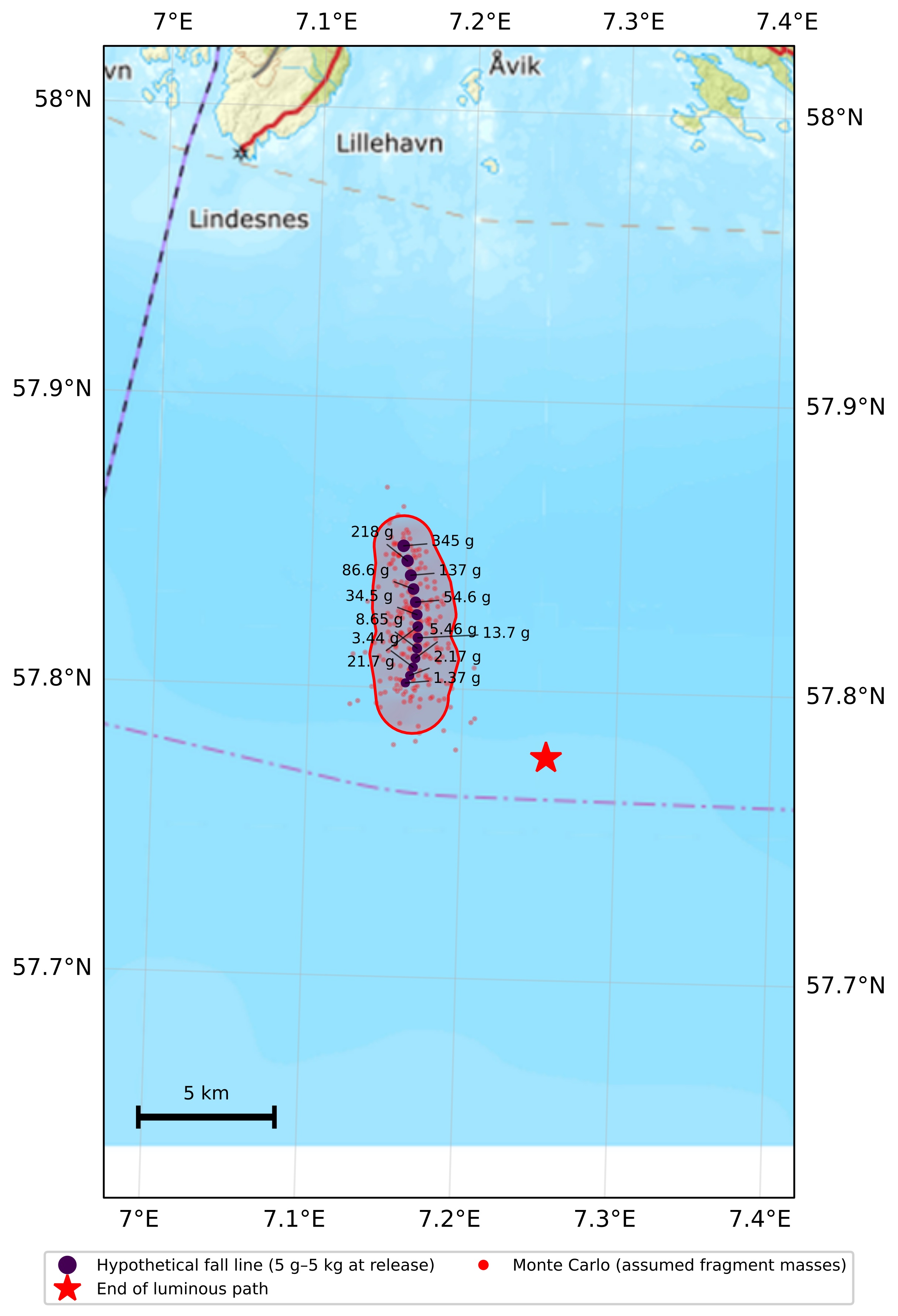
Dark-flight scenarios for assumed masses and material properties; these do not establish meteorite survival.