Meteor over Oxelösund 2021-04-03 23:04:42 UTC
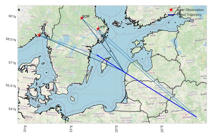
The map shows the bearings for the meteor. The lighter lines show the directions from the observation sites at the meteor's appearance, and the darker lines show where it was last seen. The blue arrow indicates the visible path of the meteor.


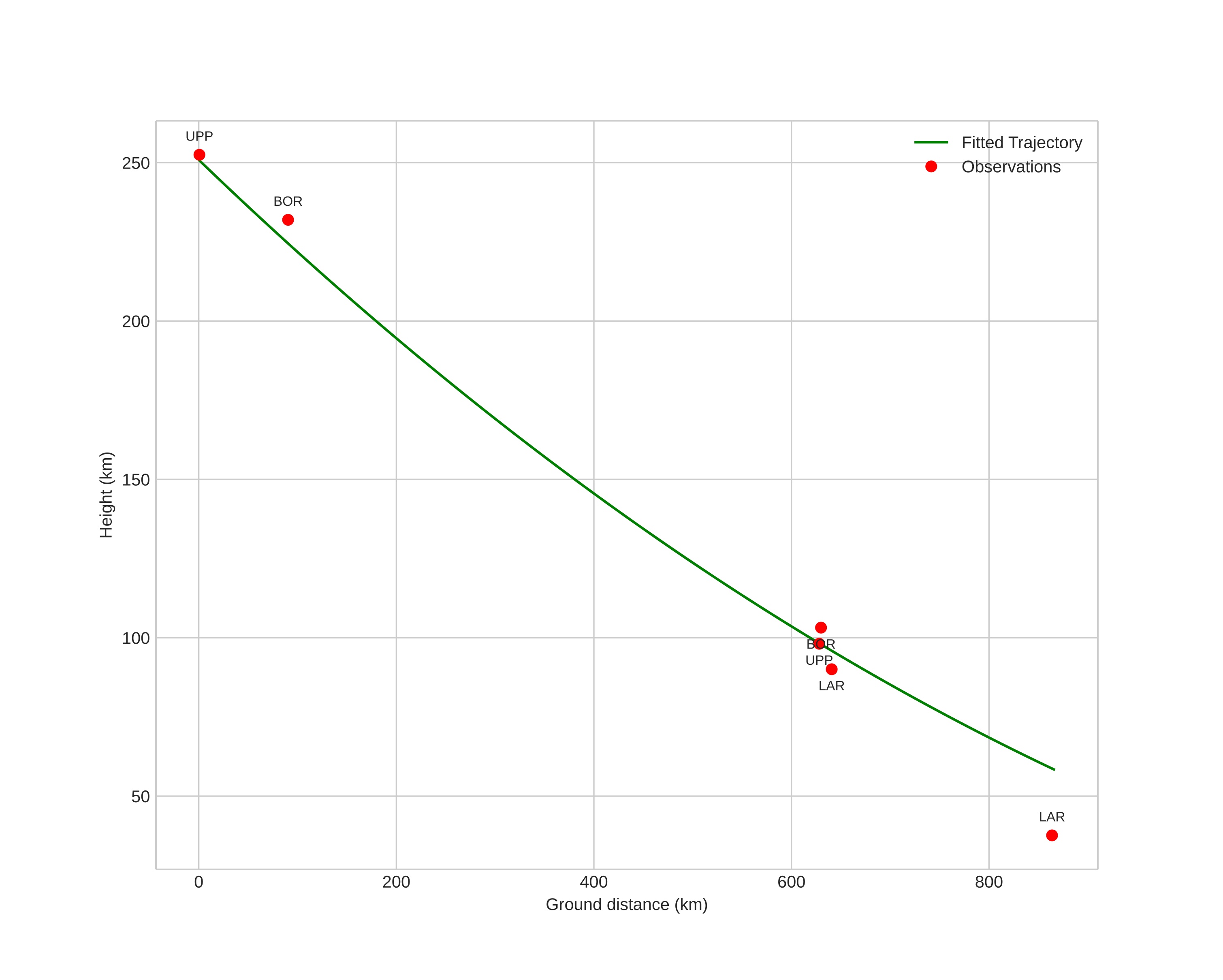
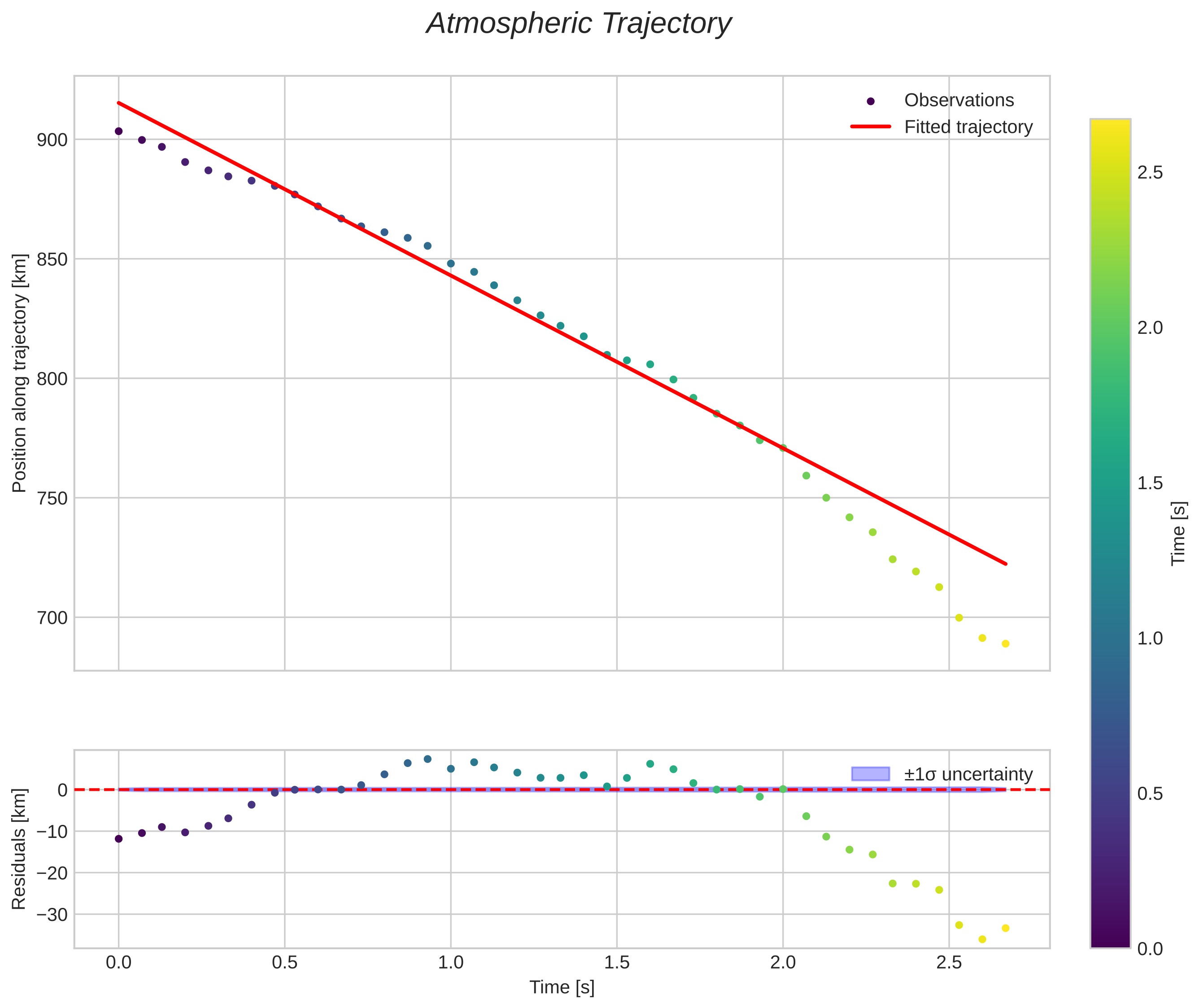
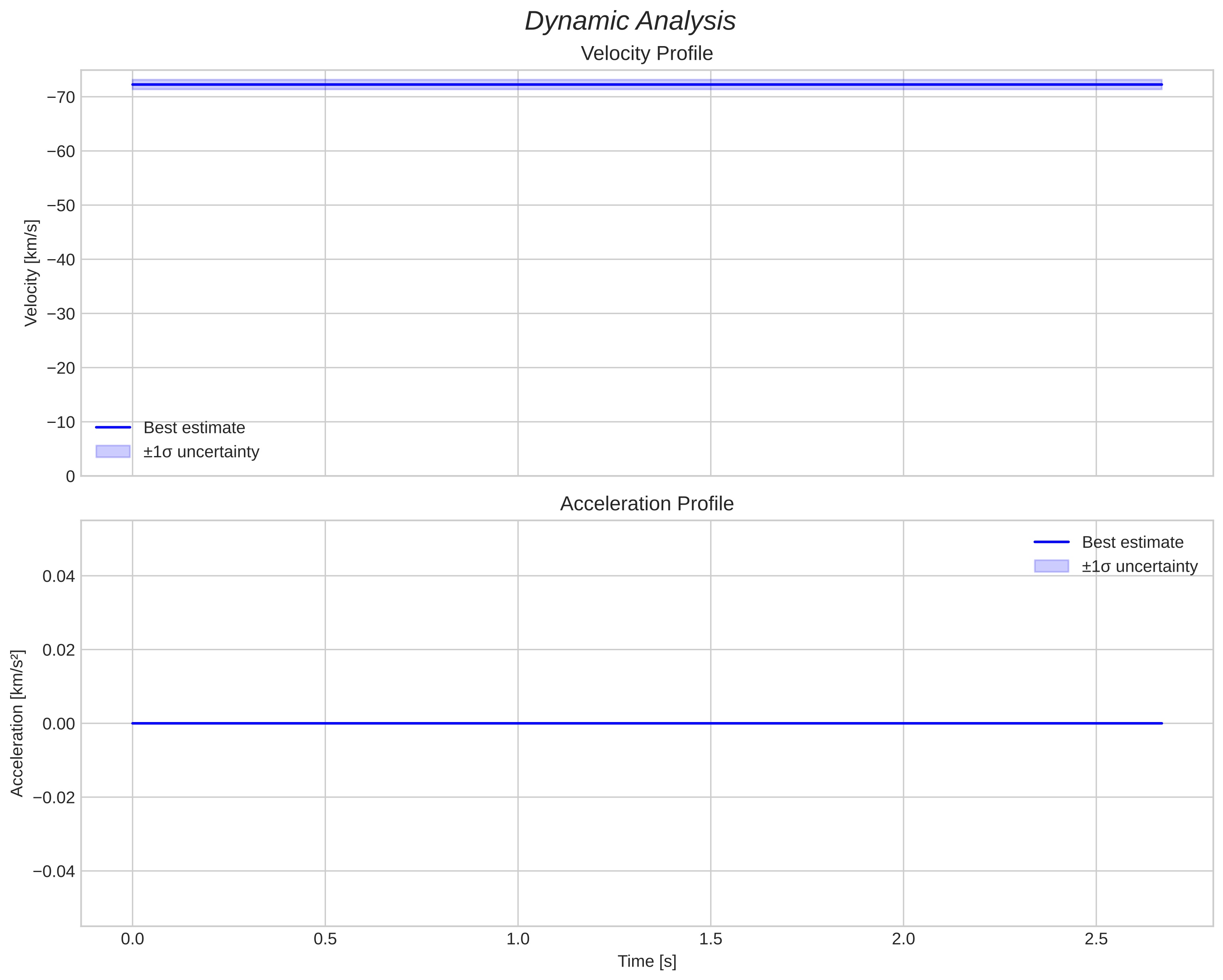
Meteor's Atmospheric Trajectory:
|

